|
|
|
|
|
|
| Home
Purpose Course Descriptions School Yachts Schedule of Courses Ocean Training Cruises ASA Certification Registration Info Our Location Our People Contact Us |
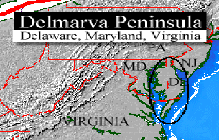
Friday, July 14- By 0900, the entire crew had arrived and we began the seminar. Vincent and Berrill joined us from Indiana, and Michael came from Kansas, so our countries mid-section was well represented on this cruise. Joe and Gary came from near by: Joe from Harrisburg, PA, and Gary from the VA suburbs of Washington, DC.After our introductions, we proceeded with the seminar, using the Maryland School Offshore Training Manual (OTM) as our guide. This class was intended to be a "basic training" for ocean voyaging as well as an ASA Advanced Coastal Cruising Class. By 1230, we concluded the basic seminar and made the initial crew assignments outlined above. These billets would be used for the first part of the cruise and then, once we reached Norfolk, the billet assignments would be rotated so that every crewmember would have a chance to do each job. After lunch, we set about making the pre-sail checks according to the OTM. Vincent reluctantly but gamely climbed the mast for the first time. The others pursued their checklists with equal enthusiasm. We also prepared a meal outline and finished provisioning the boat. By 1900, our jobs were finished and we were ready to leave the next morning during the favorable tide at 0930. We retired to the Watermens Restaurant for a final meal ashore, noting the foreboding skies to the NW. At about 1945, Rock Hall experienced a thunderstorm of near Biblical proportions! It featured hail the size of quarters along with thunder and lightening. We were pleased it was happening before we left port. We had left GRAINNE well secured but when we returned we discovered she and several other yachts had suffered damage from the hail and winds. I suspect gusts had well exceeded 50 knots. Hail had even broken windows at the Marina! But our damage was minor, the storm had passed and we settled in for a good pre-voyage sleep. Saturday, July 15- Joe had determined the currents would be most favorable later in the day and the tide would be high for crossing the Swan Creek Bar at about 0930. So we went about our final checks at a leisurely pace. At 0930, we got underway, proceeding out of the harbor and across the bar. On the way, we used the range lights to check our compass for deviation and found we had little to speak of on courses of about 300°M and 124°M. Farther north, we found other ranges to test the compass on other headings with similar results. The 8 -10 knots of wind out of the south gave us no opportunity to sail at first. so we spent most of the day plotting our position repeatedly for practice and planning our transit through the C & D Canal and the Delaware Bay. Joe found conditions most favorable to make our way though the Canal beginning at about 2000. This would start us down the Delaware Bay at about 2200, as the flooding current in the bay would begin to slacken. By 1600, local thunderstorms generated enough wind for us to do some sailing and familiarize ourselves with the rig. We discussed and practiced MOB procedures under sail, primarily demonstrating the effectiveness of the quick stop maneuver, with an MOB Drill at 1620. At 1700, we prepared a chicken stir-fry dinner early enough to eat and clean up before entering the C&D Canal. The meal prepared by Berril and David was most appreciated. At 1900, we entered the C & D at Town Point and, by 1930, we docked at Schaeffers Canal Housewhere we took on 14.9 gallons of diesel, topped off the water tank, dumped the trash, made some phone calls and then prepared to get underway for a night time Delaware Bay Transit. Thus fueled and watered, we left Schaeffers and transited the canal with favorable currents. The currents served us well and, at 2040, we exited the C & D at Reedy Point, headed over to the QG buoy at the turn in the channel near the canal, and proceeded down bay staying to the right side of the channel, keeping the greens to port. Most of the crew spent a lot of time in the cockpit as we passed the Salem Nuclear Plant, marveling at the traffic and the "light show" provided by the plant and the many navigational aids in this area. There is a major bend in the river at this point, and given the intersections of the main channel to Wilmington and Philadelphia from the bay entrance, the turn into the C & D Canal, and the branches off to Delaware City and the refinery docks, there is much to observe. Sunday, July 16- Continuing down the bay, we found ourselves in the neighborhood of Ship John Shoal at 0000, midnight. Our tactics for negotiating the tricky and often treacherous Delaware Bay were to stay just outside the shipping channel. That way, we were close enough to the deep water to stay off the shoals, yet out of the path of the many large freighters and tugs in tow that pass up and down the river with remarkable frequency. The crew had scrutinized the charts and each knew where danger lay. We constantly monitored our position by both GPS and terrestrial fixes using numerous navigational aids. This was the first night sailing experience for most of our students. After overcoming the initial distress that naturally comes with this first encounter with a very unnerving experience, they soon learned that night navigation is actually easier in some ways. The lighted navigational aids can be seen at greater distances than during the day. Often buoys can be picked up at 2 miles or more. Lighthouses can often be seen at more than 15 miles. And using the ON Charts and publications like the Light Lists and Coast Pilots, we easily identified each lighted aide by its light characteristics. Light winds required us to motor down the bay, motor sailing occasionally when the winds picked up enough. By 0400, we were in the vicinity of Brandywine Shoal Light and approaching the mouth of the bay. The watch schedule was working well and we made smooth transitions at 0000 and 0400. At 0600, we rounded Cape Henlopen and passed from the bay into the ocean. Here we began working on our DR plot. Light southerly winds persisted, requiring us to motor sail most of the way down the Delmarva coast. We stayed close to shore and thus had many opportunities to practice taking bearings and obtaining fixes by various means. By 1200 noon, we were off the crowded Ocean City, MD, skyline with many tanks and towers to use for bearings and fixes to update our DR plot.
Monday, July 17- We continued to motor sail through the night enjoying fairly clear skies, but light winds. By 0630, we were passing Cape Charles Light and, by 0930, we had CBJ abeam and were heading toward the Thimble Shoals channel where we reentered the Chesapeake Bay. We crossed the Bay Bridge Tunnel at Thimble Shoals Tunnel at 1030. Once in the bay, we elected to sight see a bit since we were very early. We motor sailed along the Thimble Shoals Channel and stopped at Fort Monroe to take on fuel. At 1300, we arrived at the Fort Monroe fuel dock only to find it closed on Mondays. We set out again, and headed up toward the Elizabeth River and Norfolk to look over the US Navys large haze gray war canoes. They are an impressive sight! By 1430, we determined it was time to head back out toward Little Creek to dock for the night. Passing through the Norfolk Harbor and around the Willoughby Bank area gave us more experience navigating in challenging waters with considerable commercial and USN traffic. The crew seemed to relish this extra practice and sight seeing feature of the cruise. At 1600, we arrived at Little Creek and Taylors Landing Marina, where we took on 36.8 gallons of fuel. It had been a long motorboat ride this time; we had logged over 42 engine hours since Schaeffers. By 1800, we secured the boat after a general cleanup and showers to head off to the Blue Crab restaurant, a Maryland School favorite haunt, to enjoy the Monday two-fer special. Tuesday, July 18- 0500 - Up early! We showered and breakfasted by 0545, and got off the dock at 0600, heading up the bay with Solomons Island the planned destination du jour. Winds were very light, but the voyage up the bay provided numerous opportunities to practice navigational exercises. Coming to Thimble Shoals Channel at 0645, we encountered an inbound freighter just outside the bridge/tunnel. Plotting his approximate position on the chart and our position, and estimating his speed to be 12 knots and ours at 5.5knots, we calculated we could not cross the channel safely in front of him and so maneuvered to take his stern. This was a revelation to some aboard, since he seemed to be far away and we seemed to have plenty of time to cross ahead. These freighters may look like they are moving slowly, but they are actually clipping along. It is easy to underestimate their speed and make what could be a fatal mistake. The rest of the day offered many similar opportunities for us to find our position and estimate our ETA at various waypoints, using tide and current tables to add to or subtract from our knotmeter speed to refine our calculations. The crew grew skilled at this. By late afternoon the SW winds picked up enough for us to enjoy a pleasant broad reach without the noise of the "iron genny." At 1900, we approached the Patuxent River and Solomons and made our careful approach in the limited light of the summer evening. Once in the harbor, we found our way to Solomons Spring Cove Marina, docked and secured the boat and relaxed. Wednesday, July 19- We got underway from Solomons at about 0800. The veering NE winds required a considerable number of tacks to get us up the bay toward our destination, Eastern Bay and the Miles River. All the while we conducted navigation exercises, playing the GPS Challenge game. Shortly after lunch we staged a surprise MOB drill, using one of the more expensive type I PFDs required for vessels venturing off shore. The crew handled it well at first, Mike serving as pointer immediately, with Gary & Co. springing to action by dousing sails and starting the engine. But in the confusion of the moment, things went haywire, and, as the crew struggle with the sails, we drifted farther and farther from the "victim." The waves were now fairly steep and before long we lost contact with the MOB altogether. It seemed lost! But given that this could have been a real person (to say nothing of the fact that the "MOB" was a $40 life jacket!), we resolved to find it, no matter what it would take. Well, it took more than 45 minutes and required setting up an orderly search pattern similar to what SAR vessels and planes would do in such circumstances. We also put one crewmember on the mast, standing on the boom to get as high as he could to scan the waters for the "victim." I was reminded of the time, on a Delmarva about 5 years ago, when we were engaged in a similar MOB exercise. A US Navy helicopter happened by, noted the strange behavior of our vessel and spotted the life jacket in the water, mistaking it for a real MOB! The helicopter quickly came to our aid! We waved him off and he realized we were enjoying a drill. The crew at the door flipped us a quick salute and they returned to their course. I wished they were here this day. Nevertheless, we prevailed after more than 45 minutes of frantic searching. Our man on the mast spotted the victim, we maneuvered along side and fished him out. Had this been a real person, surely he would have been suffering from severe hypothermia, a fact not lost on the crew and commented on at length by Dr. Mike Laccheo, our de facto ships surgeon. All found this exercise sobering. I expect that none will leave the dock again without harness and tether hooked on to the boat. At 1600, the strengthening northeast winds and rain were making things uncomfortable, causing us to rethink our St. Michaels plans. So we altered course for Knapps Narrows to our east. There we docked at Knapps Narrows Marina for the night at 1730 as the rain and wind increased. Thursday, July 20- Ater the rainy night we enjoyed a bit of a sleep-in and a nicely prepared bacon and egg breakfast courtesy of Vince. So at 0830, a well fed, most appreciative crew set forth from the Narrows and up the bay. Through the day we continued practicing various navigation exercises and refining our sailing and seamanship skills. North winds again required considerable tacking to work our way toward our objectives. We worked our way through Eastern Bay and passed Parsons Island and Crab Alley to Kent Narrows. We made the 1900 bridge opening there and proceeded to the Chester River where we practiced a night time MOB with the Williamson turn maneuver. After that, we spent a couple of hours searching for some unlighted buoys, a nun and a can. The nun "2" at the entrance to Queenstown we were able to find fairly easily, running a bearing to the flashing red in the harbor that formed a "range" with the nun in toward it. A good technique. But the Chester River can "11" eluded Gary and his cohorts and we concluded it may be off station. By 2230, we headed in to Queenstown Harbor where we dropped the hook and settled in for a good nights rest. It was cool and clear and a couple of us enjoyed sleeping on deck under the stars! Friday, July 21- Since we only had about 10 miles to go to get to Rock Hall, we enjoyed the pleasant Queenstown anchorage and slept in until about 0700. After breakfast we weighed anchor and, under Captain Berills direction and Navigator Garys guidance, headed down the Chester River toward Rock Hall. On the way we noted the green can buoy Gary, Michael and Vincent had attempted to locate the night before was, in fact, on station. We just did not find it. But we learned something about night vision and night navigation during that exercise, and next time we can expect better results. By 1100, we were approaching Rock Hall and entering Swan Creek. We stopped and fueled GRAINNE and had the holding take pumped out before heading for Spring Cove Marina and her berth. Thus Capt. Berill and crew were able to practice docking a few more times. By 1230, Berrills crew had cleaned and secured GRAINNE and left her ship shape the way we found her. The crew said their good-byes and headed off to their respective homes to contemplate what they had learned and what they still wanted to learn. Each had expanded his or her sailing horizons significantly. Captain David Appleton |