|
|
2018 Chesapeake Bay Cruise |
| Home
Purpose Course Descriptions School Yachts Schedule of Courses Ocean Training Cruises ASA Certification Registration Info Our Location Our People Contact Us |
Jun 19, Tuesday: Arrival: Day
1 – Jun 20:
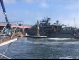
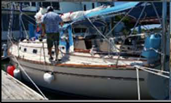
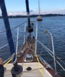
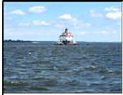
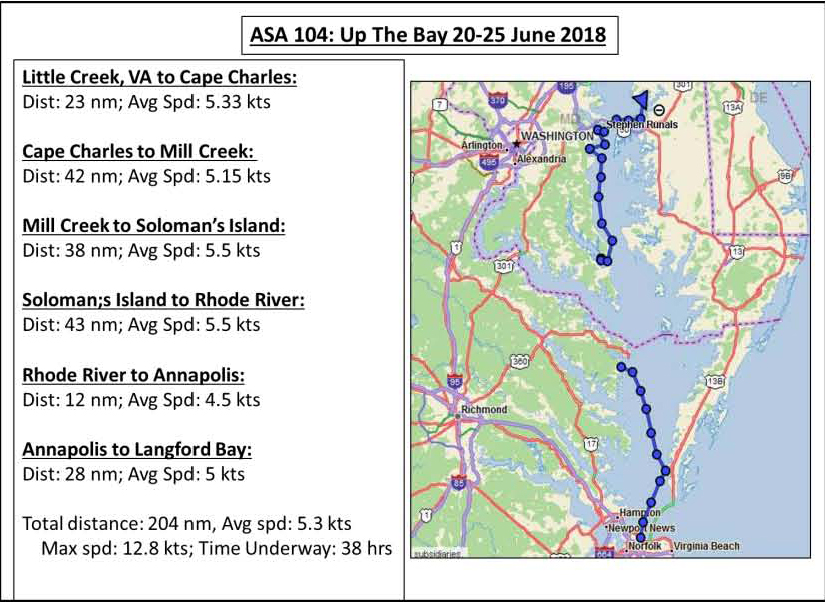
Review of Ships Systems, Rules of Road, Boat Handling, Cape Charles: Before departing we get a weather update – light winds but enough to “make a go of it” - and discuss our undocking plan. Charlie gets us past the security at the entrance to the Little Creek Amphibious Base and into the Chesapeake Bay. The trip across the Bay provides an opportunity to become familiar with the boat and the Automatic Identification System (AIS) allowing us to identify nearby boats by name, course and distance. Once across Thimble Shoals Channel, the wind begins to build from the north and we have a fine sail that allows all to get a feel for the helm and deploy all sails. At one point we are making over 8 knots in the smooth water helped along with a flood current. Along the way CJ takes several two-bearing fixes and adjusts our course to account for the wind and favorable current. Making this great sail even better is the sighting several large pods of dolphins. Late afternoon finds us sailing through what is now the Hampton Roads Anchorage for ocean going ships and a sky filled with the threat of T-Storms. Short of the Old Plantation Flats Light at the entrance to Cape Charles Harbor, we reluctantly drop our sails and follow the narrow channel using its two ranges or transits to guide us to our slip. Using ranges is a new experience for the crew; they see their value as we navigate the narrow channel. Secured by 1700 hours, the crew enjoys a well-earned dinner ashore. Following dinner Tomas, our navigator for tomorrow, lays out our course to Mill Creek off the Great Wicomico River. After this long day we turn in for a well-earned rest. Cape Charles was once the hub of a busy ferry service to and from Norfolk with both passenger and rail traffic from 1933 thru the early 1950’s. Now it’s more “laid back” but a growing center for recreational and commercial boating. Distance today: 23 nm; Average Speed 5.33 knots
Day
2 – Thursday:
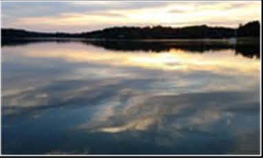
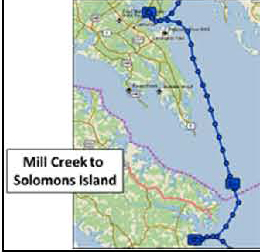
Up and Away …. Across the Bay: We practice tacking and refine our procedures for sail trim. It’s 45 minutes of excellent sailing but it’s getting late so Tom guides us through the narrow entrance to Mill Creek bordered by crab pots, fish traps and shallows into a beautiful, secure anchorage. We have the anchorage to ourselves untill just before dark when a catamaran joins us. Dinner onboard provides an opportunity to learn more about the skills necessary for living aboard. CJ, Charlie and Tom take the opportunity for a short swim as we see no sea nettles or jelly fish. Over we dinner review the day’s events. John, our navigator to for tomorrow, lays out our course which will require us to round Smith Pint Light and cross the Potomac River. Tidal currents will have an impact on the trip so we spend time reviewing the use of the NOAA tidal current tables. The forecast calls for strong winds and rain but we have a quiet night under a cloudy sky and some light rain. Distance today: 42 nm, Average Speed: 5.15 knots.
Day
3 – Friday:
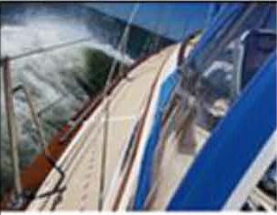
North …. always North: We put in a single reef, shortly followed by a second reef and play the traveler. All see the advantage of matching sail combinations to match the wind and seas. The staysail shows its value as it helps balance the helm as we sail north in the building seas. We have rigged the preventer, stabilizing the main sail, allowing us to safely sail on a broad reach in winds gusting to over 30 knots and seas 4-5 feet. It’s great sailing, the boat handles the wind and seas well but now the rain and fog add to the challenge. This calls for careful watch keeping that includes monitoring the AIS and radar. We coordinate passage info with a southbound boat and carefully track the passage of several northbound container ships. The mal-de-mar affects some on the crew, making the passage an even greater challenge. It’s a fast passage in these winds and seas. By early afternoon we have crossed the Potomac River, rounded Ceder Poit and into Patuxent River. The rain has finally stopped but the winds remain high as John gets us safely into Back Creek at Solomon’s Island. By 1630 we are secured at the Spring Cove Marina, pumped out and ready to stretch our legs. The afternoon and evening are spent taking showers, studying, planning our tip north and dinner ashore. It’s a nice break from the boat, providing an excellent opportunity to review the events of the day, discuss future cruising plans and drying out the boat and ourselves. Distance today: 38 nm; max speed: 12.8 knots; Average Speed: 6.50 knots.
Day 4 Saturday:
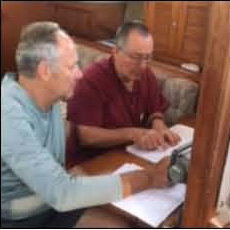
North, …always North: We get a call from one of the other school boats headed up the East River toward St Michaels. As we approach the entrance to the West River we take time to execute MOB drills under power. After securing our tipsy dummy, we carefully make our way past crab pot floats and trot lines and enter the Rhode River. The anchorage is a little crowed but provides a good exercise in choosing a spot to drop the hook. Despite the forecast for T-Storms, it’s a very quiet spot for the night. Before dinner, CJ, Charlie and John all go for swim. Dinner is followed by study for the ASA104 test. Based on the weather forecast for more light wind, we discuss the option of John and CJ taking the 104 test here before heading up to Annapolis. Charlie and Tomas have already taken the test. WE spend a quiet night in this secure spot. Distance today: 43 nm; Average Speed: 5.5 knots.
Day 5: A
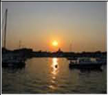
Mooring and a little exploring: After cleaning up the boat and lunch, we head into town for showers, a little exploring and an early dinner at Pussers. Charlie has to leave us here so we bid farewell to a good shipmate. CJ takes the opportunity to fulfill a long time desire and visits the Naval Academy. Dinner on an outside table provides an excellent view of the steady stream of boats moving in and out of Ego Alley and in the harbor. We head back to the boat for an early night. After consulting the NOAA tidal current tables, Tomas determines we should have the current with us for only a short portion of the trip so we plan to depart by 0530 hrs. Distance today: 12 nm; Average Speed: 4.5 knots.
Day 6:
Another Great Sail, Clean Up and Prepare for Departure and New
Adventures: Along the way we practice reefing and unreefing as the wind picks up and drops. This “take –and – shake” sailing (take it in, shake it out) is important to keep the boat “in-step” with the wind. Around Love Point we deploy the preventer and have a fast broad reach up the Chester River, gybing several times to reinforce the timing and procedures to safely execute what can be a dangerous maneuver. Once passed the entrance to Kent Narrows and around the horseshoe bend in the River, we tack our way toward Lankford Bay and home. S/V Navigator is returning to her home port for the first time since early May with 1500 blue water miles under her keel and our 204 miles covered during this trip up the Bay. We complete our final tasks of pumping out the holding tank and refueling before returning Navigator to her slip. We clean the boat, pack our gear and do a final course review. All agree it has been a great trip with lots of new skills learned and all expectations met or exceeded. Most importantly, it wetted the crew’s appetites for more. Well done to a great crew! Distance today: 28 nm; Average Speed 5 knots.
Capt Steve Runals
|


Web site design by F. Hayden Designs, Inc.