|
|
2016 Chesapeake Bay Cruise |
| Home
Purpose Course Descriptions School Yachts Schedule of Courses Ocean Training Cruises ASA Certification Registration Info Our Location Our People Contact Us |
Jun 17, Fri: Arrivals: Captain Tom Tursi and his long delayed ocean crew returned from Bermuda early Friday morning aboard S/V Navigator. The passage, marked by contrary winds, found the crew tired but Navigator in good overall condition from its 1500 nm round trip. After the crew cleared customs and departed, Tom and I replace both toilets with new ones and finish cleaning the boat. Charlie arrived as
we were in the final stages of cleaning but once we complete our work and Tom
departed for a well-earned shower and rest, Charlie helps inventory onboard
supplies. Ney is scheduled to
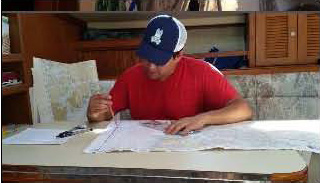
arrive later this evening so Charlie and I develop a draft cruising plan with
an initial menu before going to dinner and doing some provisioning.
Ney lets us know that his arrival by train is delayed but should be
able to arrive by 2200. Greg
emails to tell us he has missed one of his flights and will not be able to
arrive until early afternoon on Sat. Flexibility
is a key aspect of cruise planning and execution so we develop a modified plan
for our departure and check with Greg to see if he has any food requests
before we drop off to a well-earned rest.
Day
1 – Jun 18, Sat:
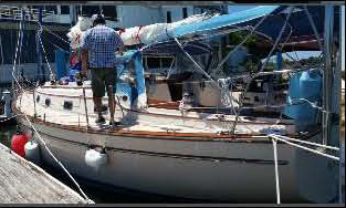
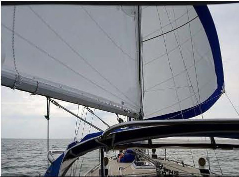
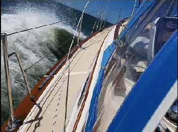
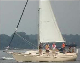
Review of Ships Systems, Rules of Road, Boat Handling, Cape Charles: After lunch, we complete our departure preparations. Once Greg arrives, we review safety procedures, discuss our undocking plan, and get a weather update. The crew has wanted to sail in some high winds; their wish is granted, the forecast calls for NE winds 15-20 with gusts to 25 knots. I take us out of the slip; once clear of the marina, Charlie takes the wheel getting us past the security at the entrance to the Little Creek Amphibious Base and into the Chesapeake Bay where we find the forecast has indeed lived up to expectations. The wind and waves provide an interesting challenge to getting the main sail up and confirm for the crew that this trip will give them an opportunity to grow in skill and experience. Ney tracks our progress as we head north across the Thimble Shoals shipping channel updating our position as we sail close hauled toward Cape Charles. We rotate the job of helmsman among the crew, giving each a taste of big boat sailing in these wind and sea conditions. All are impressed with the way S/V Navigator handles both. Late afternoon finds us off the entrance to Cape Charles Harbor and its two ranges or transits. This is a new experience for the crew; they see the value of ranges as we navigate the narrow channel. Once secure at the dock, the crew enjoys a well-earned dinner ashore; we stretch our legs and give Greg a more detailed orientation of the boat and her systems. Greg gets his wish to improve his navigation skills by laying out our course to an anchorage in Mobjack Bay’s East River for tomorrow. After this long day we turn in for a well-earned rest. Cape Charles was once the hub of a busy ferry service to and from Norfolk with both passenger and rail traffic from 1933 thru the early 1950’s. Now it’s more “laid back” but a growing center for recreational and commercial boating.
Day
2 – Sun:
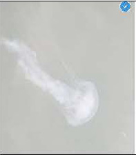
Up and Away …. Across the Bay: Dinner onboard provides an opportunity to learn more about the skills necessary for living aboard. Ney braves the sea nettles and small jellyfish for a short, refreshing swim while Charlie plots our course for the next day - up the Bay to an anchorage in Mill Creek off the Great Wicomico River. He has some questions about the narrow entrance to the anchorage but accepts the challenge to get us there without running aground. We share our anchorage with a late arriving catamaran that gives us an interesting display of how not to anchor. We have a quiet night under an almost full moon before turning in to get ready for tomorrow’s challenges.
Day
3 – Mon:
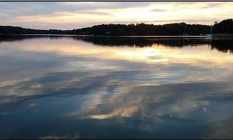
North …. always North: We initially are able to take advantage of the flood current till we pass the Rappahannock River, then we face an increasingly unfavorable ebb as we proceed north. By early afternoon the wind has dropped, and with thunderstorms in the forecast, we finish our day’s trip motor sailing. As we enter the Great Wicomico River, Charlie carefully guides us through the narrow entrance to Mill Creek bordered by crab pots, fish traps and shallows. He has already determined that we will enter the Creek at low tide so a careful watch by all is essential. We anchor in a beautiful, quite spot and enjoy the rest of the afternoon swimming and discussing the day’s events. Dinner onboard and a quiet night without the forecast rain make for a nice rest for all.
Day
4 – Tues:
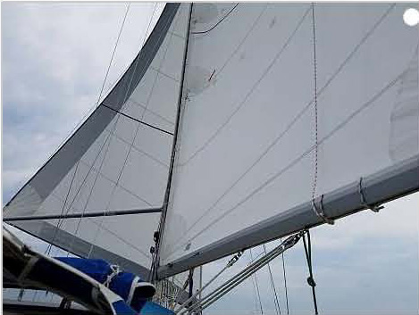
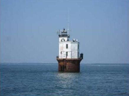
North, …always North: As we are getting set to raise our mainsail, I see a boat approaching from the rear. My slip neighbor at Ft Monroe who has been out on the water for the past 10 days sails by. We wave hardy greeting as he heads south toward home and we head north to the Potomac. Once clear of the now much reduced Great Wicomico Light and numerous crab pot floats and fish traps, we turn north, round the Smith Point Light and have an uneventful crossing of the Potomac River. The steady winds allow us to practice sailing wing-on-wing and rigging a whisker pole to maximize the 10 -15 knot SW wind. While crossing this artery once so important for our trade and our early history, we consult the cruising guide to help recount some of the information about this important river as we cross its wide mouth. Lighthouses at Point Lookout and Point No Point provide the opportunity to take two bearing fixes and work on taking a running fix as we track our way north in a dying wind. It also gives us the opportunity to gain much appreciated hands-on experience in using the AIS (Automated Identification System) to monitor a constantly passing array of power and commercial shipping. A look at the sky and an update from the NOAA weather radio indicate that we are in for possible sever showers and thundershowers with hail and damaging high winds so we make best speed under power into the Patuxent River. Charlie gets us safely into Back Creek by Solomon’s Island and I take the boat into our slip at the marina. We tie up just as the wind and rain hit. Fortunately it is short lived so after well-earned showers, we take the courtesy shuttle to the Lighthouse for an excellent dinner. It’s a nice break from the boat, providing an excellent opportunity to review the events of the day and discuss future cruising plans. After dinner we use the shuttle to do a little more provisioning and return to the boat to plan tomorrow’s trip north.
Day
5 – Wed: North, …always North: We enter the West River in dying winds and another forecast for showers and severe thunderstorms. Greg has a challenge keeping us on course as we weave our way through a broad field of crab pot floats. Once clear of the pots, we enter the Rhode River and head to an anchorage that Greg has picked out that should be secure in our current NW winds as well as those forecast to back to the S overnight. A few boats join us in this quiet anchorage were discuss the day’s events and enjoy wine and cheese before making dinner followed by a quiet night at anchor.
Day 6 – Thurs:
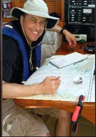
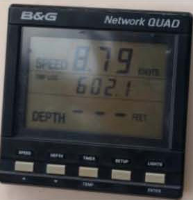
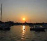
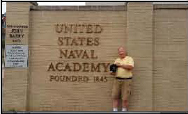
Rain, the Test ….. a little exploring Raising the anchor again calls for a little encouragement – it was well set – but we are soon on our way through the crab pots and into the Bay. The winds are light and variable. We are able to do a little sailing but end up motoring our way around the Thomas Pt Light. The day has cleared nicely and lots of boats are about as we head into the Annapolis mooring field. Always great to see the range of activity in this busy port – from young kids zipping around to J-World racing classes to paddle boarders and tour boats all competing for the same space. Greg guides us safely through this constantly shifting mass of sail and power to our mooring and Ney and Charlie have us secured to a mooring on the first try. Following showers ashore, the crew heads off to visit the Naval Academy, the state capital and water front area before we meet for dinner at Pussers. It’s always a great show watching the constantly changing activity in the harbor from an outside table there. While we have missed the Wednesday night races, there is plenty to see. After returning to the boat, Ney plots our course for tomorrow. It will require an early departure and after consulting the NOAA tidal current tables, he determines we should have the current with us the entire trip home – a first. Our target is to be at the Love Pt Light by 0800 tomorrow.
Day 7 – Fri:
Clean Up and Prepare for Departure and New Adventures The wind picks up so we attempt some MOB drills but the wind again turns light. We pass close by the school’s two IP 32’s headed south – all three of the school’s boats out in the same vicinity – a great sight. As we pass, the crew of Acadame gives Navigator and her crew a welcoming salute. Navigator is returning to her home port for the first time since early May with 1500 blue water nm under her keel and our 160 nm covered during the trip up the Bay. We complete our final tasks of pumping out the holding tank and refueling before returning Navigator to her slip. As we approach the slip, we are hit by a heavy rain shower but secure the boat with only a little delay. The crew recommends we delay the final cleanup till after lunch and the rain stops so we head into town for a quick lunch before returning to the boat, clean up and final goodbyes. All agree it has been a great trip with lots of new skills learned and all expectations met or exceeded. Most importantly, it wetted the crew’s appetites for more. Well done to a great crew!
Captain Steve
Runals
|
Web site design by F. Hayden Designs, Inc.