Course: Offshore Passage Making,
Norfolk to Bermuda
Date: May
26-June 2, 2003
Vessel: IP45 HALIMEDA
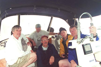
Students: Art Shearer, David Pope, Jim Walker
and Falk Kantor
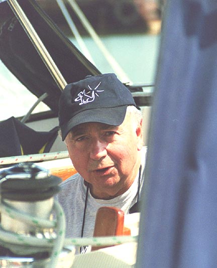
First Mate: Jim Bortnem
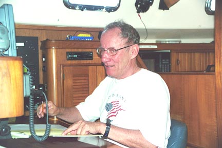
Captain: Tom
Tursi |
Sunday, May 25
HALIMEDA recently arrived in Norfolk after the offshore cruise north
from St Thomas with Captain Hal Sutphen. All was in order with only minor
problems to deal with. I've been onboard for a few days getting ready for the
cruise to Bermuda. Today, my crewmembers arrived including First Mate Jim
Bortnem and students Art Shearer, David Pope, Jim Walker and Falk Kantor. Some
slept onboard and some decided to tough it out in a local hotel during the next
few days of preparations.
Monday, May 26
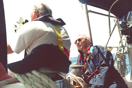
Today we began pre-departure training and preparations including sail, winch
and line handling techniques. At dockside we deployed, one at a time, the
mainsail, staysail, jib and trisail and also the jib whisker pole. We rigged and
deployed the sea anchor equipment and reviewed procedures for its use including
techniques for heaving to. Reviewed check lists in the school's Blue Offshore
Training Workbook.
Tuesday, May 27
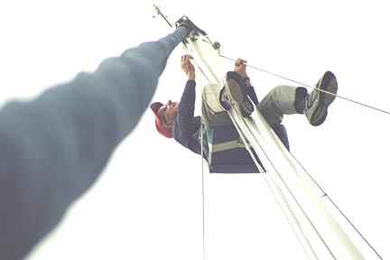
Completed the pre-departure check lists including going up the mast. Checked
the spare parts and food inventories and made lists of purchases needed.
Reviewed navigation and logbook procedures, setup the plotting sheets, reviewed
the Radar unit operation and interpretation, and reviewed weather forecast
sources including the VHF and SSB radios, the NAXTEX receiver and the Weather
Fax unit. Inspected and briefed on all belowdecks equipment and procedures
including the stove to avoid fires and the heads to avoid blockage. Shopped for
additional food provisions needed.
Wednesday, May 28
Practiced Abandon Ship and Man Overboard procedures; made abandon ship
assignments. Made watch assignments as follows: Art Shearer & Jim Walker on
12 to 4, Tom Tursi & David Pope on 4 to 8, and Jim Bortnem & Falk Kantor
on 8 to 12. Reviewed watch keeping procedures and duties with special emphasis
on ship and tugboat lights and protocols. Recorded weather forecasts via VHF and
SSB and downloaded the Weather Fax surface analysis report.
Weather looks good for departure today; skies are partly
cloudy with winds from the SW at 10 knots. Yesterday, a Low Pressure system
passed over Cape Hatteras and is now out to sea. Forecast is for S to SW winds
at 10 to 15 knots, which will give us a starboard beam reach on our rhumbline
course of 115T. We topped up water tanks, settled with the marine, made final
calls home and, at 1200 Noon departed Little Creek, Norfolk, VA bound for
Bermuda.
After rounding Cape Henry at Chesapeake Bay entrance, we
turned SE and headed down the traffic separation lanes. The VHF radio broadcast
a USCG alert that a US Aircraft Carrier was proceeding inbound to Chesapeake Bay
and warned all traffic to stay well clear. In the distance we could see this
behemoth a few miles ahead. It was flanked by a cordon of USCG escort vessels,
one of which took a position between us and the Carrier. She maintained this
position until we were fully by, all the while keeping her bow (and a big gun)
pointed at us... once clear, she turned and sped off to the next encounter.
Winds remained light from the S to SW and we variously
sailed or motor sailed as the winds increased or decreased. Rain squalls hit in
early evening followed by cooler air and a beautiful rainbow. Made 62 NM as of
midnight.
Thursday, May 29
At 0430 hours we sighted the triple yellow lights of a tugboat crossing our
bow from right to left. The triple yellow lights signify a tow of over 200
meters in length, but were unable to visually discern her barges in the early
twilight. And our radar did not distinguish the tug from its tow, but did show
that she would pass less than a mile ahead of us. As she loomed larger we could
make out one barge with no green light showing, and I called the tug on VHF 13,
the bridge to bridge frequency, and asked how many barges were in tow. The tug
captain came back that there was only one. We then saw the white stern light of
the barge and knew that she was full and by.
Winds continued S to SW at 10 to 15 with clear skies
throughout the day. By late afternoon a squall hit and the mainsail first reef
line let go at the block inside the boom, necessitating that we use the second
reef. It did not appear feasible to repair the first reef at sea and we used the
second reef for the remainder of the trip to Bermuda when needed. For the
remainder of the night we experienced a succession of lightning squalls and
driving rain with winds to35 knots. As of midnight, we completed 130 NM during
past 24 hours.
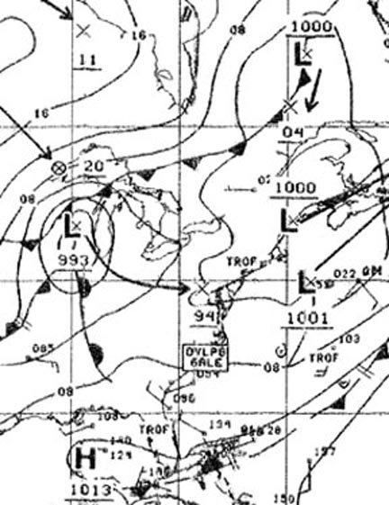
Friday, May 30
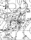
The weather fax shows that we're between two Lows, one to our north and one
to our south and both moving to the NE. The SSB voice forecast from NMN,
Portsmouth, VA calls for SW 10 to 15 today and tomorrow, and predicts that a Low
currently over the Great Lakes will move SE to New Jersey by Saturday and bring
winds of SW 35 to our area on Saturday and Sunday. With the numerous Lows
galloping over and around us, it was interesting to me that the weather service
focused on this one particular, distant Low... time will tell.
 |
 |
 |
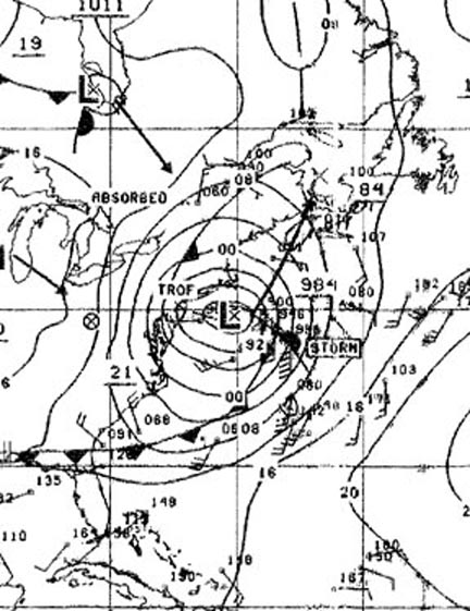
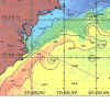
| Gulf Stream, May 21 |
Weather Fax, May 30 |
Weather Fax, June 1 |
Skies cleared by 0500 hours and we were able to get some
good sun shots. By 1300 we entered the Gulf Stream. Winds dropped overnight
necessitating that we motorsail. Completed 151 NM during past 24 hours.
Saturday, May 31
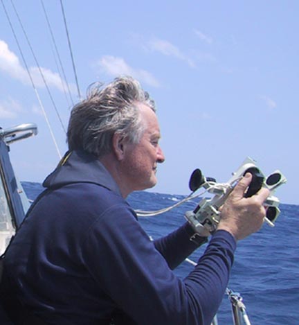
Bright, clear skies today; winds S to SW 10-15. Ideal conditions for
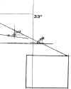
celestial shot accuracy drills which Art, David and Jim W participated in. The
objective here is to achieve consistently accurate shots on a rolling, pitching
little boat at sea. This requires repetitive shots and comparison with the GPS
position using a celestial calculational computer. Once the navigator
understands the correct shot picture and swinging techniques needed to achieve
accuracy, confidence increases, and we put away the electronics and concentrate
on applying celestial LOPs to our navigational plot.
The NMN weather forecast continues to predict that the
Great Lakes Low will pass over New Jersey and out to sea by tonight and bring
winds of SW 35 to 40 tonight to our area. Completed 142 NM during past 24 hours.
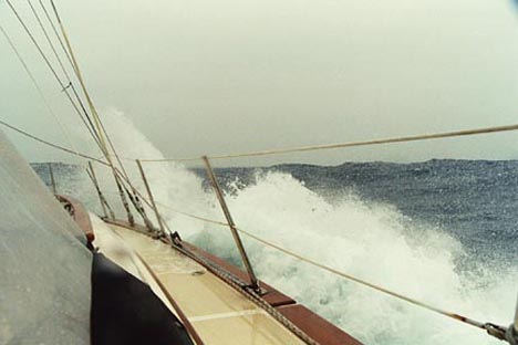
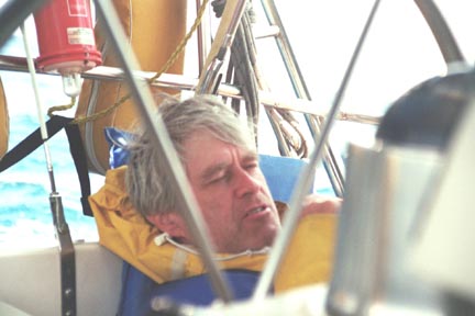
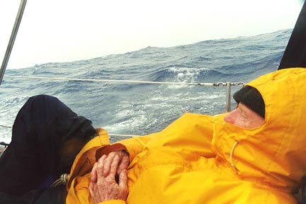
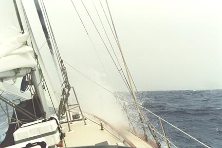
Sunday, June 1
As predicted, winds began to build overnight reaching SW 35 to 40 knots by
0800 and remained above 35 knots until late evening when it began to abate. Our
course to Bermuda put the wind at about 80 degrees relative to our starboard bow
and we charged along at eight knots with staysail and deep reefed mainsail.
Waves were 10 to 12 feet and occasionally one would break over the boat and into
the cockpit but not too often.
We experimented with different headings to see which gave
the smoothest ride. Heading up to 60 degrees relative reduced speed and we began
to pound hard on the waves. Heading off to 100 degrees relative increased speed
too much and further exposed the cockpit to breaking waves. So we settled in to
80 degrees relative as optimum for these wind and wave conditions, which also
kept right on track for Bermuda. Completed 176 NM during past 24 hours, which
averages to 7.3 knots.
Monday, June 2
Winds dropped to SW 10-12. At 0200 hours we called Bermuda Harbour on VHF 16
and identified ourselves and gave our ETA at St Georges. They asked the usual
litany of questions about our yacht, equipage, crewmembers, port of departure,
etc and asked us to call in again when reaching Mills Breaker Ledge outside of
Town Cut Channel.
 |
 |
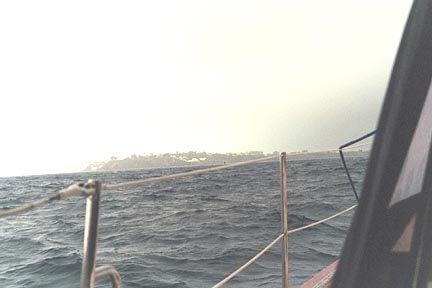
| DR position approaching Bermuda |
Bermuda Landfall |
At 0800 we arrived at the appointed spot and received
permission from BHR to enter Town Cut. Completed 42 NM since midnight. Proceeded
to the Customs dock on Ordinance Island; cleared in; fueled at Dowling's Shell
and tied up at Trimmingham's Warf. Everyone was happy to arrive on dry land
after an exciting ocean cruise, and went to town to enjoy the sights of Bermuda.
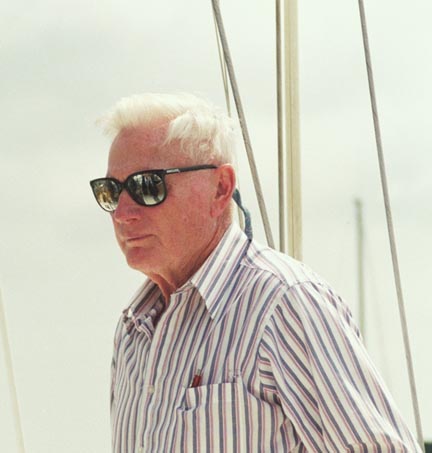
Captain Tom Tursi
S/V HALIMEDA
St Georges, Bermuda
June 3, 2003

to Ocean Reports
Return to Home

|