|
|
2001 Bermuda Reports |
|
|
2001 Bermuda Reports |
| Home
Purpose Course Descriptions School Yachts Schedule of Courses Ocean Training Cruises ASA Certification Registration Info Our Location Our People Contact Us |
I learn something new on every ocean cruise regardless of
the number of times I've been out there. This time, I learned something new
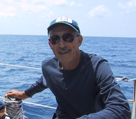
about Gulf Stream eddies... more on this later. We were in St Georges, Bermuda with First Mate Ron McKie
and myself cleaning up from our outbound trip and getting ready for the return
cruise. Weather was typically Bermudian late spring: warm, sunny, SW breeze,
passers-by stopping to chat, huge cruise ships tied nearby, the Town Crier
demonstrating the ducking stool for visiting throngs, ocean sailors coming and
going from all parts of the world, para-sailors soaring overhead, local
fishermen arriving with fresh caught tuna, sea stories spun at the
sidewalk pub... altogether, pleasant surroundings.
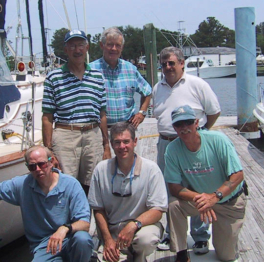
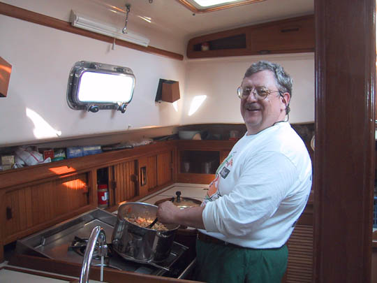
Our outbound student crew had departed for home and our new
crew began to arrive. Glenn Carmichael from Alabama was staying locally
at Aunt Nea's guest house and had visited a few times prior to the start of
training. On Tuesday, June 5 Bob McConachie from Texas arrived in late
morning to say hello, get acquainted and look over the boat; he would be staying
at a hotel in Hamilton until we departed and he motor-biked between there and St
Georges. At noon, Pete Ambrose from New Jersey and Greg Harville from
New Hampshire arrived and
stayed onboard during the period of pre-departure training.
Wednesday, June 6: We began pre-departure training sessions with a discussion of onboard procedures using The Maryland School's Offshore Training Cruises Manual, a complete inspection of all below decks equipment, unfurling of all sails at dockside, demonstration of reefing, gybing and other sail handling procedures, inspection and practice with safety equipment including sea anchor, man-overboard and abandon ship, navigation procedures, watchkeeping and logbook procedures, weather reports and analysis, inventory of tools, spares and food provisions, and to the top for a complete mast and rigging inspection. I assigned Pete Ambrose and Greg Harville as Bosn's, Glenn
Carmichael as Emergency Coordinator and Bob McConachie as Engineer for the
inspection and checkout duties prior to departure. And, I assigned Pete and Greg
to Watch Section I from 12 to 4 with Pete as Watch Captain for the first three
days and Greg as Watch Captain for the remaining days. Further, I assigned
myself and Bob to Watch Section II from 4 to 8 with me as Watch Captain. And I
assigned Ron McKie and Glenn to Watch Section III from 8 to 12 with Ron as Watch
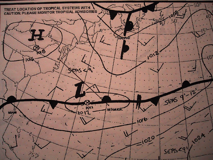
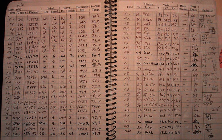
Captain. The Bermuda meteorological office provides an excellent set
of weather graphics for sailors at the Customs office. Between these and the
reports that we receive onboard over SSB radio, VHF radio and NAVTEX receiver we
have a fairly complete picture of expected weather conditions. On June 8th, the
day prior to our scheduled departure, the forecast showed a stationary front
lying along latitude 33 degrees north and a series of low pressure systems
moving west to east along this front and a forecast of gale force winds near
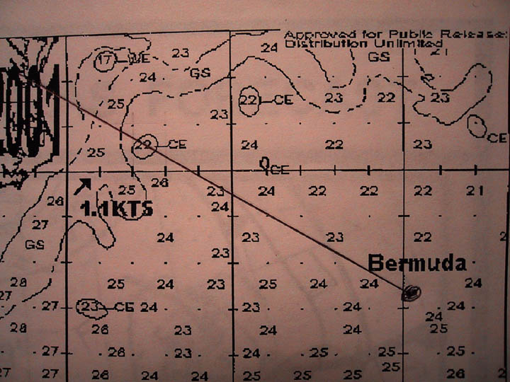
Bermuda. Also, a cold eddy was shown lying directly on our rhumb line to
Norfolk.
We opted to delay our departure for one day to June 9th to
allow conditions to settle down a bit before taking to sea. On June 9th, the
weather charts showed a low directly over Bermuda and the weather was squally
with heavy rains and SW winds to 30 knots. It also appeared that the front was
now just north of Bermuda and the forecast was for winds to clock to NE. With
conditions improving, we made final preparations to depart, cleared out with
Customs, cleared out with Bermuda Harbour Radio, and at 10 am in torrential rain
made for Town Cut channel and the open sea. Wind, waves and rain continued as we
sailed on port tack in SW winds of 25 to 30 knots making a course of about 295
degrees true which was close to our desired rhumbline. These conditions turned
the complexions of a few of our crewmembers green as they returned a measure of
last nights fish & chips to King Neptune. Sunday, June 10: By 0100 winds clocked to NE at 18
knots and we were able gybe over to starboard and free up sheets to a
comfortable reach while sailing the rhumbline. Later, winds lightened and backed
to WSW allowing us to sail close hauled in relatively calm seas and my
"greenies" began to look human again. With clearing skies, we were
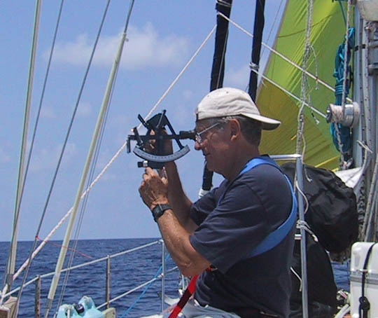
able to get some good celestial shots to confirm our DR position, and as of noon
we had covered 142 miles since leaving Bermuda. Forecasts were for winds to
remain SW at 10 to 15 knots.
Monday, June 11: This was a brilliant, sunny day
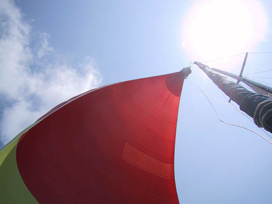
with winds SW 10 to 15 and light seas. At 1000, on port tack, we put up the
cruising chute and had a beautiful sail in ideal conditions until mid-afternoon
when winds died and we had to go on engine power. As of noon, we covered an
additional 119 miles, but our noon weather report contained a disturbing note.
Tropical Storm Allison which ten days earlier had gone ashore in Texas and was
forecast to expend itself over land, had revived and was heading NE to the East
Coast and possibly into our path. Bears watching.
Tuesday, June 12: Winds continued from the SW at 10
to 15 knots under mostly clear skies and we continued our fine sail along the
rhumbline. The 0530 weather report again mentioned the remnants of Tropical
Storm Allison and that it would move NE to South Carolina today; winds for us
were expected to remain SW at 10 to 15 knots. The evening forecast placed
Allison off of Cape Hatteras by Thursday and to stall in that area just when we
expected to be there.
Prior to our departure, the Gulf Stream forecast showed a cold eddy on the eastern edge of the Gulf Stream and directly on our rhumbline. Cold eddies typically rotate counter-clockwise and usually travel in a SW direction at just a few miles per day. Based on this usual expectation, I planned to stay close to the rhumb line and to intersect the east edge of this eddy which would sweep us NW then W then SW as we rode its periphery while maintaining our rhumbline heading. Well, so much for what typically happens! This eddy moved in the wrong direction; it traveled NE rather than SW! Thus we ended up on the wrong side of it and experienced an opposing current rather than the expected lift. This slowed our speed over ground to about four knots for most of the day. I've surmised that since this eddy was close in to the edge of the Gulf Stream, that it was swept NE by the stream rather than drifting SW as they usually do.
Otherwise, winds remained a cooperative 10 to 15 knots from
the SW and we continued good progress making an additional 120 miles noon to
noon under mostly clear skies. Wednesday, June 13: By morning we cleared the cold eddy and entered the Gulf Stream temperatures jumped from a low of 75 F to 82 F and we were making a course over ground of 360 degrees true while steering 300 degrees true; clearly a lift from the stream. Our noon to noon distance log was 147 miles and by early afternoon we exited the Gulf Stream indicated by water temperatures dropping to 75 F and our course over ground correlating closely with our steered heading.
From here we had about 100 miles to our destination
and winds remained a friendly 10 to 15 knots from the SW later backing to a more
favorable SE under partly cloudy skies. The weather forecast continued to place
Allison off of Hatteras but we never experienced any problems from it.
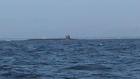
Thursday, June 14: By 0700 we reached the Chesapeake
Bay Junction Buoy after being passed by a US nuclear submarine on the surface.
After rounding Cape Henry at 0730, I called the US Customs Office on my cell
phone and they kindly cleared us in based on this call. By 1030 we entered
Little Creek Harbor, site of a Navy amphibious base, and on to Taylor's Landing
Marina our destination. We had covered the distance of 662 miles through the
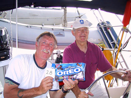
water in five days for an average of 132 nautical miles per day; and Ron and
Glenn won the coveted Oreo Award for the most miles covered on a single watch. It was a good
cruise with new experiences and new shipmates; we all enjoyed it, but were glad
to be back home.
Captain Tom Tursi |