|
|
2022 DELMARVA Reports |
Home
|
Here we sat, First Mate Captain Jerry Nigro and I, onboard
S/V NAVIGATOR ready for crew arrival and the start of a DMVA
circumnavigation cruise, but tropical storm IAN had other plans for us. She was
coming up the Eastern Seaboard packing winds of 60 knots and a major rain dump
and headed toward us... Well, sort of toward us, but still with enough wind,
rain and cold temperatures to dampen even the best of sailing enthusiasts. So,
based on forecasts and past knowledge of these kinds of weather patterns, I
reluctantly made the decision to pull the plug on the start date for this cruise
and notified Rita, our office Guru, to notify the four student crew of a
three-day delay and to come to the boat Monday hence rather than Friday
tomorrow. Fortunately, we did not need to abort the cruise entirely because all
student crew had previously agreed to a potential five-day weather delay to
accommodate the possibility of such events especially at this time of year just
past the peak of hurricane season on the East Coast. So Jerry and I told sea
stories, took naps, fiddled with light fixtures, purchased food supplies, told
sea stories, speculated on the weather, got repeatedly soaked in the rain... You
get the idea. Finally Monday dawned, skies began to clear and life was good! Monday afternoon, October 3rd about 1500, our four
student crew arrived: Mark Lindberg, David Schrump, Trish Farrow and Eric
Carnell, and we proceeded with their gear stowage and below deck inspections and
boat familiarization per the training plan. Then to dinner ashore and early to
bed in preparation for a full day of pre-departure training tomorrow. Two of the
students elected to sleep ashore in hotels to alleviate the crowd aboard and two
slept onboard along with Jerry and I. On Tuesday October 4th bright and early with all six
crewmembers aboard, we got to work with boat inspections above deck, sail
deployment and handling at dock, review of boat procedures and check lists, and
navigation preparations per the training plan. At 1700, after a full day of
training and inspections we went to dinner ashore in anticipation of an early
departure tomorrow.
Wednesday morning October 5th was again clear but fairly cold at 45ºF with expectation of a high in the upper 50's. On the way out of the marina, we stopped at the waste pumpout station and emptied the holding tank. Our plan for today is to deploy all sails underway, practice sail handling drills and proceed to a mooring ball for overnighting at Swan Creek Marina. Wind was about 15 knots from the north as we proceeded down Chester River, and we had a fine downwind wing-on-wing sail. Wind direction and course changes required the we make several gybe maneuvers during this leg and this gave us ample opportunity to practice the all-important PST-TSP gybe procedures described in the training plan. After passing the horseshoe bend at the south
end of Chester River, we headed north and into a 12 to 15 knot wind from NNW,
which made for a fine, close-hauled sail up the remainder of the river to the
junction with Swan Creek approach channel marked by green buoy #1. At this point
we secured sails and proceeded under engine power, arriving at Swan Creek Marina
mooring field by about 1500. After settling in to the mooring, the crew got to
work completing navigation preps for tomorrow's trip up Chesapeake Bay to the
C&D Canal. Dinner onboard was pasta and meatballs with a side of fresh cut
veggies followed by cookies, chocolate, tea and coffee. Berthing is tight for a
crew of six adults on a 40-foot boat, but we managed ok with a camping mattress
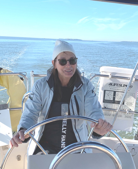
added to the main cabin sole for the night. Thursday October 6th: All rose from sleep at 0630, quickly dressed, completed pre-departure checks, cast off the mooring pennant and were underway by 0700. Heading out the Swan Creek channel past the red 6 beacon, we turned southwest at green 5 buoy to cross the Swan Point bar (local knowledge) and out to the Chesapeake Bay main channel where we turned north to follow the channel per the navigation plan prepared yesterday by the crew. Winds were very light, less than 5 knots from the west, so we motored all the way to C&D Canal and into Summit North Marina. During the trip up the bay, student crew went onto one-hour helm tricks and one hour as on-watch navigator. Weather
was calm with good visibility making for good conditions to practice taking
visual bearings on prominent land objects to enable plotting lines of position
(LOP) for position fixes and running fixes. Students commented that they found
this process more difficult to accomplish than previously thought from their
academic study of these techniques. Some of their difficulties were: (1)
Identifying prominent land objects and correlating these with the paper charts,
(2) Their unsteadiness on a moving boat, albeit in calm conditions as we had,
leading to varying magnetic bearings, (3) Achieving good crossing angles of two
or more LOPs, and this had to do with the physical locations of successive land
objects relative to the boat position, and (4) Position fixes that correlated
closely with our GPS position. But, this is part of the learning process and why
practice is very important to hone these skills and achieve practical accuracy. We also used this transit time up the bay for all crew to
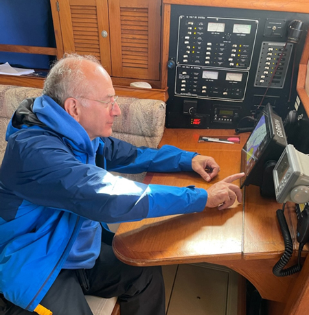
become familiar with the onboard electronics, including the Chart Plotter, AIS,
MARPA and RADAR, and correlating this information with actual visual observation
of other vessel traffic and collision avoidance measures. These skills will
become vitally more important as we proceed to the later cruise legs down
Delaware Bay, offshore down the Atlantic Coast, and back north up Chesapeake Bay
from Norfolk which will include two night transits with ship traffic moving
close by at 18 or more knots. And we practiced obtaining weather forecasts from
the VHF radio, Sirius XM satellite and IridiumGO satellite from NOAA, NHC,
Predict Wind, Passage Weather and SailMail and applying this information to our
cruise plans and timing.
About 1600, we arrived at Summit North Marina in the
C&D Canal and ran hard aground in the entrance channel requiring that we be
towed off, and the marina accommodated us in this with its little outboard mule.
We then went to the fuel dock to top up our diesel tank and pump out our holding
tank, then docked in a slip and went to dinner at the Grain Restaurant.
Then to the large navigation preparations for the next half of the cruise down
Delaware Bay and the Atlantic Coast to Cape Charles and the southern entrance to
Chesapeake Bay. This was a long session and we all turned in about 2300 with
plans to arise early and get underway by 0700 tomorrow. Watches will be as
follows:
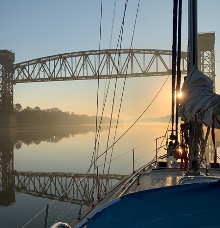
Friday October 7th: Again we were up at 0630,
dressed quickly, completed pre-departure checks and were underway by 0715. Skies
were clear with wind from the west at less than 5 knots and some early morning
mist; cockpit surfaces were wet with overnight moisture. We passed through the
marina entrance without grounding this time. Our bow lookout verified that the
canal was clear of traffic and we did a left turn to enter the canal eastbound,
verified that the Conrail railroad bridge was in the up-position, and we set the
throttle at 2400 rpm providing a boat speed of about 6.5 knots in these smooth
waters. Eric, Mark and Tom were on watch at this time. Jerry cooked up some
delicious cheese omelets for breakfast, and we began to talk of the entrance
navigation from the canal into the Delaware River. Checking the USCG Local
Notices to Mariners, we noted that dredging may be in progress in the Delaware
River main channel south of the C&D Canal.
There are two long rock jetties running east from the
C&D Canal banks and into the Delaware River that we must be careful to
visually identify and avoid. These rocks sometimes are submerged if tides are
running high, and I know of one sailor who cut it too close and lost his boat on
the rocks, so I advise extreme caution when passing through this inlet. To
ensure that we are far enough out of the canal and fully into the river before
turning south, we used the red over green channel junction buoy RG
"CD" 29 to mark our turning point; when this buoy is abeam to our port
side, we will be far enough out of the channel to turn to a course of 160 psc
and head for the G "11" buoy of the Delaware River main channel.
Because of the considerable ship traffic constantly transiting Delaware River
& Bay, we will stay outside of the main channel on the western side and keep
the green buoys to our port side all the way down to Cape Henlopen. Delaware Bay is a nasty bay due to extensive shoaling, strong currents, significant wave action when wind opposes current, and the many ships traveling up and down the bay. But it will be daylight for our entire trip to Cape Henlopen and this will provide an excellent training opportunity for watch keepers in meticulous tracking of ships and the many smaller vessels that ply these waters. Recognizing an approaching ship and what direction it is traveling takes skill and practice, both day and night. AIS gives us the bearing, distance and course of the ship and its projected closest point of approach (CPA) to us, but it takes a thoughtful strategy and a trained eye to safely pass the ship. First, if traveling in inland waters with a ship channel
like Delaware Bay, the prudent strategy is to stay out of the ship channel
whenever possible. We planned our route outbound in Delaware Bay to stay out of
the channel on the green side; that is, we left the green buoys to our portside.
This placed us in shallower waters than the channel. With a 40 foot depth in the
channel, a ship drawing 35 feet is compelled to stay in the channel, and we are
in a safe zone of 20 or 30 feet. If for some reason the ship strays out of the
channel, it will soon run aground and come to a sudden stop before crushing us. Next is to recognize with your eyes whether the ship is
going straight or turning left or right, and to anticipate what its next move
may be. This requires the practiced visual recognition of what direction the
ship is currently traveling relative to us. At night, the pair of white range
lights on large ships over 50 meters in length are the main indicator of a
ship's direction of travel; and the red or green sidelights can confirm your
assessment if they are also visible. Daytime is actually somewhat more difficult to judge
a ship's direction since the ship is not displaying nav lights and you need to judge
its direction by deciding whether you are seeing the portside or starboard side
of the ship; this is especially hard when the ship is close to heading directly
toward you. And lighting conditions can cause confusing illusions of the ship's
image; sometimes it's hard to tell whether the ship is heading toward or away
from you. Bottom line is that it takes practice. Also, there's the question of anticipating which way the
ship will be turning as it approaches a bend in the channel since you expect the
ship to turn with the channel. You can use this expected heading change of the
ship to practice the visual changes that will accompany that change. Did the
ship's port to starboard image change logically in your mind as it followed a
left turn of the channel? Practice. Practice. Practice.
And this we did as we proceeded down Delaware Bay. Another issue that we dealt with and practiced in Delaware
Bay was whether navigational beacons or lighthouses were on our side of the
channel or the opposite side. The importance of this rests with the tendency of
the helmsman to steer toward a tall distant NavAid, but this will put us into
the channel if it is on the opposite side. So, during nav prep we identified
which side these very visible beacons are located, and during cruise we ensured
that the helmsman was informed of this fact. A related tool that we practiced is the cross-track error
function of the chart plotter that tells the helmsman how far off of the
intended track he is at any given moment. Normally, the helmsman is directed to
follow the compass course developed during the nav prep phase, but several
factors, such as current and wind leeway, may cause the boat to deviate from
track even if the helmsman is steering the correct course. So, cross track error
can be used to inform the helmsman, and he should slowly ease the boat back to
track by gradually reducing this error. The importance of this is that being off
of the intended track may unknowingly place the boat in the ship channel or into
the shoal waters adjacent to the channel, two areas that we want to avoid. So, practicing these skills as we proceeded down the bay
kept the crew busy with the learning process in addition to operating and
managing the ship on a continuous basis including helming, watch keeping,
navigation, weather monitoring, hourly inspections of boat systems, log keeping
and more. About 1600 we passed Brown Shoal light, which marks the end of the
ship channel, and the waters opened up as we approached Cape Henlopen and the
junction with the Atlantic Ocean. Shortly after, we sighted the Cape May to Cape
Henlopen ferry ship about two miles to our portside on a crossing course. We
called them over VHF radio and asked their intention; they replied that they
would take our stern, and we proceeded on course. Trish and David prepared
dinner for the crew, a delicious chicken and noodles stew served piping hot...
Yum! We rounded Cape Henlopen and into the Atlantic as the sun
set and darkness began to close in; winds remained light from the SE, pretty
much right on our nose. Our first waypoint here was the G "5" Fl G 2.5
sec buoy past Cape Henlopen laying between the shoreline and the Pilot Area
marking the beginning of the ship traffic lanes. From there, we will head south
remaining between shore and the ship lanes where they end in about 23 miles.
From there we will angle further out to sea to stay clear of the near-shore
shoals and activity. And now for an overnight cruise in the Atlantic...
At 1800 the wind clocked to 225ºT and increased slightly
to 8 to 10 knots; not much but we were able to set the mainsail with the 1st
reef in as the weather forecast predicted increasing winds from the NW after
midnight. Saturday October 8th just after morning midnight, the winds clocked further to NNW and increased to 15 knots and we set the staysail along with the reefed mainsail. Within 15 minutes the wind rapidly increased to 30 knots with gusts to 40 knots and we scooted along at 6 plus knots. Waves gradually built to six feet from our starboard quarter giving the boat a typical corkscrew motion and an exciting ride for the crew who did well and learned the fine points of steering at sea under these challenging off-wind conditions. We made good speed and direction during this period heading directly toward our next waypoint near the Chesapeake Bay entrance, and these conditions persisted until noon when the wind moderated to 15 knots. About 1800 we arrived at red buoy
"N2" at the entrance to the bay as the sun was setting. Twilight
persisted most of the remaining way to the Chesapeake Bay Bridge at Fisherman's
Island, which we crossed under in complete darkness at 1930. Then to the several
mile run up to Cape Charles Town entrance channel, which is always a challenge
to make in darkness because of the many background lights that confuse the
entrance navigational lights. But the crew came together well for this task and
we docked in a slip at the town marina at 2200. Fortunately, a neighboring
boat owner heard us arriving and lent a welcome hand with dock lines. And so
ended this leg of our cruise as we turned in for the night with plans to be
underway tomorrow after noontime. Sunday October 9th: Crew got up from sleep about
0800 and got right to work doing nav prep for the trip north up the bay directly
to Rock Hall, our home port. They were now old hands at this having done it for
the three previous cruise legs, and they had a system that worked well. Tom gave
some general guidance for preferred routes through the various areas of the bay,
some with ship channels and some without, as we needed to be cognizant of where
ships were likely to be traveling. For example, ships will be in the main
channel where the is one, and certainly will be in the traffic lanes rounding
Smith Point, so we need to logicalize where they might be traveling in the open
areas between channels, and we included this rationale when planning our route.
By the way, tugboats often do not operate in the ship channel because of their
shallower draft than ships and they also do not want to needlessly encounter
ships passing close by.
Also, when crossing under the Annapolis Bay Bridge, we will continue our
practice of staying out of the main ship channel, and we'll use the northbound
auxiliary channel with the red buoys to our port side. With these thoughts and
guidance the crew set to work developing the details of our navigation plan
using the paper charts, light list, notices to mariners, and the coast pilot,
and Tom cooked cheese omelets for the crew for breakfast. After cleanup, weather forecasts and pre-departure checks,
we departed the slip and headed to the fuel dock, topped up fuel, pumped out the
waste tank, settled our bill and departed Cape Charles Town at 1300. Watches
continued as before, so Trish, David and Jerry were on watch initially and we
had the usual turkey, cheese and tomato sandwiches on Dave's multigrain bread
for lunch.
Winds continued light from the NW, skies were clear and bright, and we proceeded
under engine power at 2400 rpm and practiced our watchkeeping skills in
preparation for the overnight passage tonight. It was a very easy passage, both
day and night... Monday October 10th: The sun rose bright and clear
with light wind from NW and we continued under engine power. At 0800, we passed
Annapolis town, but we couldn't go in because of the ongoing power boat show,
and we headed straight to the Annapolis Bay Bridge. By 1100 we were well up the
Chester River a few miles south of our marina, and we conducted a calibration
run of the speed/distance instrument, which gave a calibration factor of 0.89
very similar to previous calibrations during earlier cruises of 0.88 and 0.85...
We also did a compass calibration using the Sun as a True direction reference. We arrived at Lankford Bay Marina about 1400, pumped out
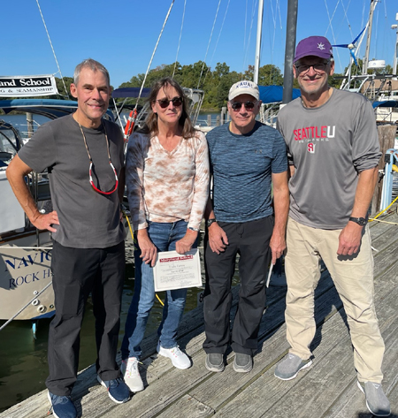
the waste tank and proceeded to our home slip, backing in as usual. Trish, Eric
and Jerry were anxious to get on the rode home, so they offloaded their gear,
and we took crew pictures, presented diplomas and they headed out. Mark and
David sat for the ASA106 written exam and then departed for home by 1400.
All gone, I sat down, had a beer and peacefully reflected on the just-completed cruise and of the many enjoyable moments of the past week. Watching the crew come together from day one when we were six individuals to the last day when we functioned as a well-oiled team is a pleasure to behold. Captain
Tom Tursi
|
|||||||||||||||||||||||||||||||||||||
Web site design by F. Hayden Designs, Inc.