|
|
2021 DELMARVA Reports |
Home
|
Circumnavigating the Delaware-Maryland-Virginia (DMVA)
peninsula is always an exciting and interesting advanced coastal cruse because
of the variety of waters and weather conditions encountered. Being a hundred
miles or so north of the infamous Gulf Stream and Cape Hatteras adds a degree of
uncertainty to the expected weather conditions, and this uncertainty encourages
meticulous preparations of the boat, crew, navigation, weather analysis,
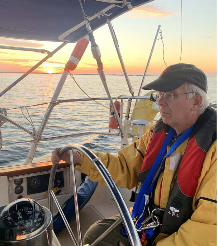
training and operational procedures. We will be sailing NAVIGATOR,
our well-found Island Packet 40 foot cutter rigged blue water boat with many
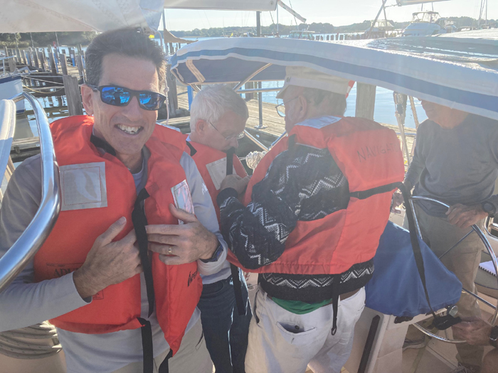
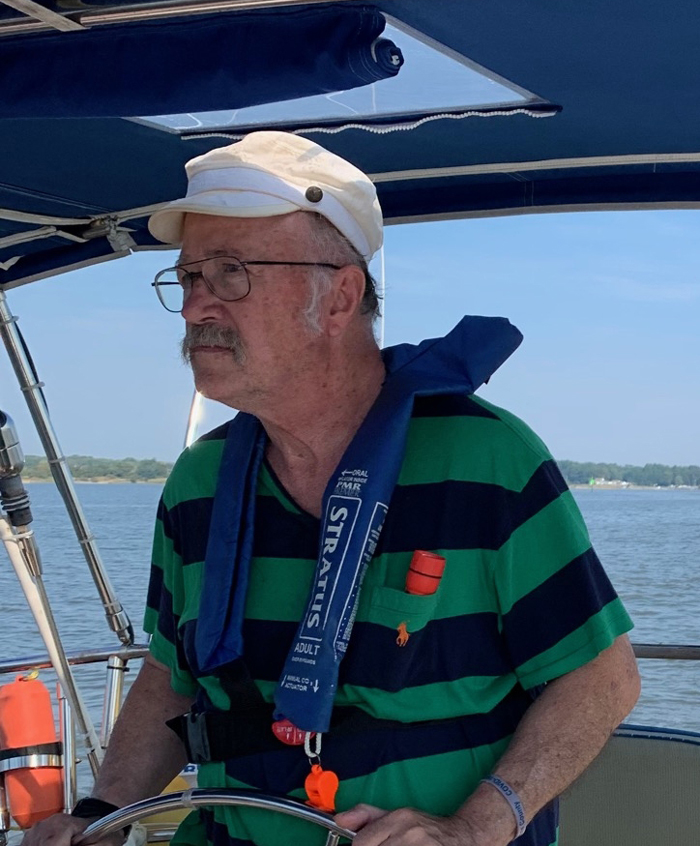
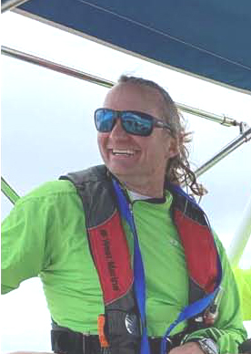
ocean miles under her keel. Crew included four experienced student crewmembers Jamey Kabisch, Mark Meredith, Hugh Calkins and Bill Marshall, plus First Mate Captain Jerry Nigro and Skipper Captain Tom Tursi, both of whom are experienced, long-distance ocean sailors with multiple trans-ocean passages to their credit. This cruise offers certification for the American Sailing Association's ASA108 Advanced Coastal Cruising standards for which three of our student crewmembers planned to complete.
Three weeks prior to this cruise, we held an online crew
meeting to discuss plans for the cruise, pre-arrival navigation assignments for
the student-crew, and personal preparations for the student crew. The cruise distance around the DMVA peninsula is about 450
miles of which half is in the Atlantic Coastal waters and the generally nasty
Delaware Bay; the other half is in the Chesapeake Bay most of which we plan to
transit at night. The entire cruise, including crew preparations and training,
usually takes seven or eight days and includes port calls at Swan Creek near
Rock Hall, the C&D Canal and Cape Charles Town in the southern Chesapeake;
usually we also stop at Annapolis but bypassed it for this cruise since the
Annapolis Boat Show is in progress and finding an available anchorage or mooring
would be next to impossible. Thursday-Friday: Saturday:
The staysail boom originally rigged on NAVIGATOR
was long ago removed and the staysail was re-rigged as a jib with two sheets and
two winches; this allowed the staysail to be better set flat to avoid flogging
and leech flutter in heavy wind conditions. We practiced deploying and furling
this sail also, which is fairly simple due to its small size and the way it's
rigged. After lunch aboard, we deployed the whisker pole used to
sail wing and wing off the wind with the genoa deployed to the windward side and
mainsail to leeward side. This whisker pole on NAVIGATOR is an
18-foot, non-extendable 4-inch diameter aluminum pole stored vertically on track
cars on the mast. It is heavy and dropping it accidentally could do serious
damage to people and equipment, so proper handling is essential, especially in a
rolling seaway. So, we practiced this deployment following the step-by-step
procedures in the training Plan book. Now, by mid-afternoon on Saturday, we prepared the
navigation plan for tomorrow's cruise to Swan Creek, about 15 miles distant from
our marina. The basic process that we use for all of our cruises is to prepare
the complete navigation plan using paper charts and the USCG Light List and
Notices to Mariners, plus the NOAA Coast Pilot and local cruising guides, after
which we enter waypoints into the electronic chart plotter. This process is
described in detail in the Training Plan and is demonstrated in our YouTube
video titled "Navigation Preparations for and Advanced Coastal Cruise"
at https://m.youtube.com/watch?v=uy6vs8FtH28&t=587s Sunday:
We then proceeded to the nearby Long Cove Marina to pumpout
the waste tank, and from there to the Chester River to deploy the sails and
practice tacking, gybing and reefing sails underway, then motored to Swan Creek
in light winds where we took up a mooring ball at 1530 for the afternoon and
overnight. We had an early dinner of pasta and meatballs then to the navigation
preparations for tomorrow's run up the bay to the C&D Canal. All turned in
early to their bunks, with two of the crew electing to sleep in the cockpit on
the camping mattresses since the weather was dry and comfortably warm. Monday:
We arrived at the Summit North Marina in the C&D Canal
at 1500 where we docked at the fuel dock and pumped out the waste tank and
topped the diesel tank, then proceeded to our assigned slip on C-dock and went
to dinner at the Grain restaurant followed by navigation preparations for the
cruise legs down Delaware Bay and coastal Atlantic and into Cape Charles Town in
the southern Chesapeake Bay. That night it poured rain so sleeping in the
cockpit was not an attractive activity, so everyone made the best of six
crewmembers sleeping below deck. Tuesday:
Departed Summit North Marina at 0800 and ran into fog in the canal, which burned off before we got to the Delaware River. After the previous two days underway, the crew was now in the groove with handling the helm and sails, watchkeeping, underway navigation, collision avoidance, and onboard routines of meal preparations and sleeping arrangements. Breakfast was generally on your own for each crewmember, I usually made sandwiches for lunch for the crew, and Hugh and Mark usually cooked the evening meal which was served by 1700 to get it done and the galley cleaned up long before dark settled in.
Skies were overcast with stratus clouds for the trip down
the Delaware River and Bay with winds generally from the East or Northeast at 10
knots early in the day and up to 17 knots after noon; slight rain after noon.
This allowed us to sail on a close reach, port tack, from the head of Delaware
Bay to Cape Henlopen, rounding this cape at 1800 as evening pressed in and we
entered the Atlantic. At this point we needed to stay between the shoreline and
the outbound Traffic Separation Lane where large commercial ships are exiting
the bay and making 18 to 20 knots heading out to sea. So we steered a course
half way between the shoreline and the traffic lanes for the next 20 miles where
the traffic lanes end and it becomes a free for all, which requires keen watch
keeping and collision avoidance practices. Easterly winds continued at 15 to 18
knots overnight and into the next day, and we enjoyed a beautiful overnight sail
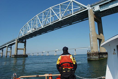
on a close reach. Wednesday: This channel is marked with four unlighted red buoys and one unlighted green buoy that we needed to visually identify in the fading light of twilight to ensure that we did not collide with them. From the red and green buoys at the end of this channel, we turned toward the bridge opening (actually two bridges) and the green pair of centerline lights hanging down below the bridge span. This pair of greens acts as a light range that lines up when we are located in the channel and passing through the two bridges. As we approached the bridges, we announced "Securite" over VHF channel 16 and identified ourselves as approaching the bridge opening to alert other vessels.
North of the bridge we are now in the dark after sunset,
and there are two unlighted buoys that we needed to identify: one is the Red
over Green channel junction mark, which we will leave to starboard; the second
is Green Can #13 which we will leave to port. We determined the bearing and
distance to each of these buoys from our current position and used this
information to locate them in the dark with our spotlight. After this, it is a
straight shot to Cape Charles Town channel entrance guarded by the bright white
light of Old Plantation Flats beacon and the Green lighted buoy, G
"1CC" Fl G 2.5 seconds where we make a right turn into the Cape
Charles Town channel. This channel makes four turns needed to enter Cape Charles
Harbor and is marked with two sets of range lights and a number of lighted
beacons plus numerous background lights that distract your vision when trying to
follow the channel. Entering this channel at night is an all-hands activity. We
had Hugh as navigator stationed below at the paper charts and electronic
plotter, Jamey on the helm, Mark and Bill stationed as lookouts in the cockpit,
Jerry coordinating activities in the cockpit, and I was communicator between the
navigator and cockpit. Everyone was well briefed as to the plan for
transiting this channel, and all went well with no foulups, and we were parallel
docked at a T-head in Cape Charles Marina by 2100. All hit their bunks pretty
soon after arriving, well satisfied with the passage that we had just completed. Thursday-Friday: We encountered several commercial ships, some northbound and some southbound, requiring close attention to our position relative to them to ensure safe passage. Your eyes can deceive you as to what you are looking at when a ship is approaching in the dark of night, so it is essential to regularly check the radar and AIS to have a clear idea of the location, course and speed of other vessels, and then look out and correlate visually what the radar and AIS are showing with what your eyes are seeing. Also, sometimes an AIS image on screen is lost in the crowd of other colors and markings, so the crew practiced the procedure of clicking down six levels on the chart plotter to find the near-hidden AIS list which shows all AIS contacts listed in order of distance from us; sometimes you find a contact not previously noticed on screen. In addition, it's essential to track radar contacts that are not AIS-identified because not all vessels are AIS-equipped, and for these we used the MARPA tracking feature on radar. The USCG Notices to Mariners, previously discussed, advised
that the Great Chesapeake Bay Schooner Race will depart southbound from
Annapolis at Noon today with eighteen schooners from 35 to 157 feet headed to
the Norfolk area. So we are expecting to encounter these vessels during the
nighttime hours while we are headed north. And, sure enough, we did meet them.
Some were well lighted; some were not. Some had AIS; some did not. Some were
good radar targets; some were not. Overall, we visually spotted about half of
this fleet spread over several hours, and made safe passes with all, but it was
a little hair raising at times. Friday: Captain
Tom Tursi
PS- Mark Meredith sent the following note, which captures
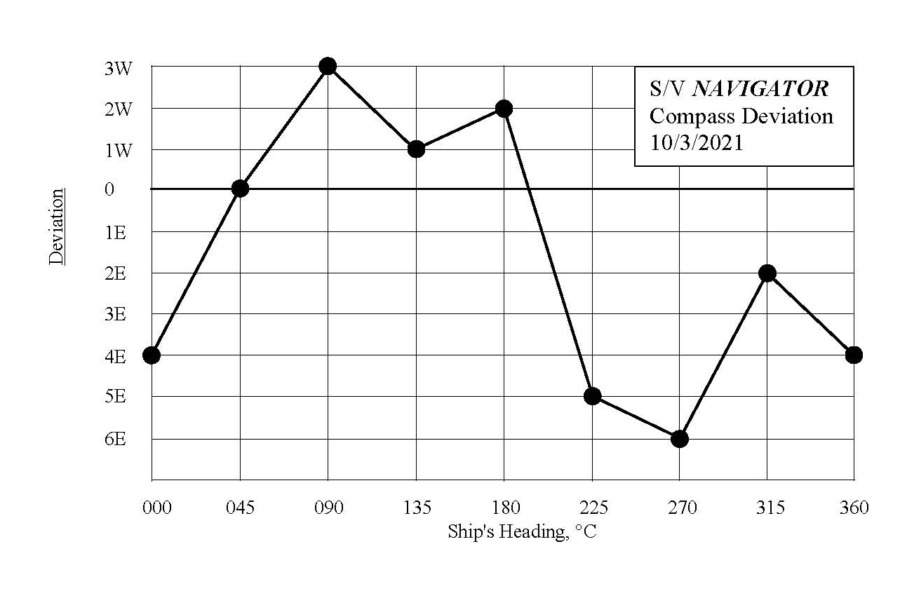
many of the moments during the cruise: Hi All, · Sailing for hours and hours on the open ocean with no land or other vessels in sight · Full foul-weather gear on the night shift in the Atlantic · Like trying to sleep in a washing machine · "I will leave you on my starboard" - two horn blasts in the middle of the night · AIS and visual tracking of fishing vessels at night in the Atlantic · 2 ounces of Yuengling · “Were you able to sleep?” “……I’m not sure….." · Hugging the outside of the shipping lanes · Trying not to hit unlit buoys at night · Getting a visual from the companionway and realizing the dozen tankers showing red on the AIS were all at anchor · Two range markers clearly aligned at night at Cape Charles entrance · Fighter jets and racing schooners · Tom’s awesome sandwiches for lunch · Strapped in at the galley with the waist belt · Hammering through the nav prep as a team – course, waypoints, distances, TVMDC, light list numbers · The rhythm of the six-hour shifts · Forgetting to check the odometer when handling off the helm · The coffee cup deviation test · Lack of sleep and sea sickness, and trying to stay focused ·
Shooting the breeze in the cockpit with Hugh and Jerry during our
night shifts ·
Nailing a two-bearing fix and running fix for the first time · A beautiful sunset and a beautiful sunrise · Lightning bolt and thunderstorm while sleeping in the cockpit · Weaving through the C&D Canal with no other boat traffic · Proper steps for a smooth helm transition – “The boat is mine” · Heavy fog on the morning departure from North Summit Marina · 20-knot winds and ocean rollers on the night shift on the Atlantic · The sound of the wind and the waves, and the ocean spray · The joy of being under sail Take care,
|
|||||||||||||||||||||||||||||||||
Web site design by F. Hayden Designs, Inc.