|
|
2018 DELMARVA Reports |
Home
|
Friday, July 6th Saturday After this we went to dinner at Harbor Shack Restaurant
followed by an evening session for navigation preparations for the next day's
cruise to Swan Creek; a discussion of the deck logbook and watch-keeping
procedures; and a review of MOB, Fire Fighting, Flooding and Abandon Ship
procedures. After this we turned in exhausted to rest up for tomorrow's underway
training and cruise to Swan Creek. Student Skipper assignments were made as follows: Marc D
starting at 1800 today followed by changes daily at 1800 in the following order:
Mark H, Chris and Dean. The Student Skipper role is to direct other students in
the operation of the vessel as described in the Training Plan. Sunday
And underway watch assignments were made as follows:
We got underway at 0940 to depart Lankford Bay Marina and
begin the DMVA cruise. The first underway event planned was to calibrate the
water speed instrument, but this had to be deferred as the instrument was not
registering, this no doubt due to fouling from sea growth. We then calibrated
the ship's steering compass near Cacaway Island using the Sun Dial method; Marc
D was at the helm and Chris marked the Maneuvering Board Chart; we obtained data
on eight headings at 45º intervals with plans to calculate results at a later
time. We then continued down Langford Creek, passing the GR
Junction buoy at 1030, then to begin underway sail training starting with
raising the mainsail with Marc D directing per Procedure #5 of the Training
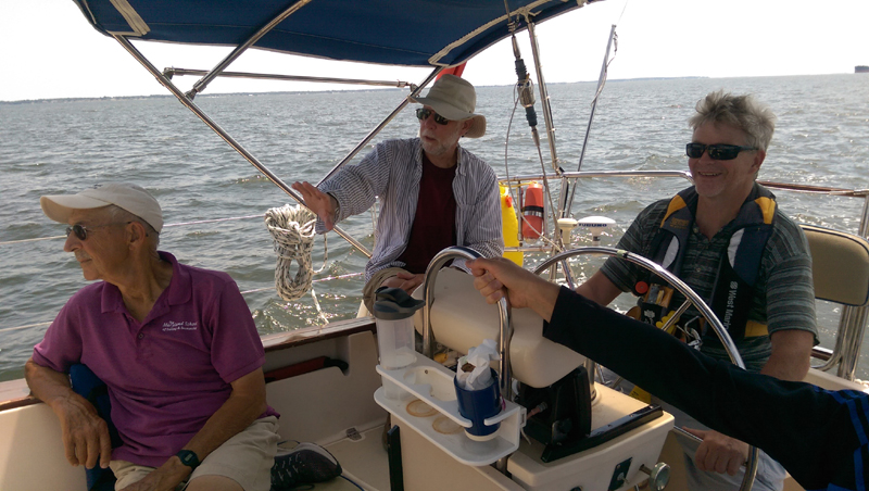
Plan. David is the Reader and Tom is on the helm. We then followed with underway
sail training exercises including: rigging preventer, controlled and accidental
gybe, reefing mainsail, unfurling/furling the staysail and genoa, and
rigging/derigging the whisker pole. A primary emphasis of these exercises is to
develop teamwork among the crew as teamwork is essential in advanced coastal and
ocean sailing situations where mistakes can magnify and become very damaging to
equipment and people due to greater levels of wind and wave. The written
procedures and checklists of the Training Plan can facilitate this teamwork
development, and that is what today's practice was intended to accomplish. We also conducted an MOB recovery drill of the Weenie dummy
from a close-hauled heading using the quick-stop motorsailing procedure. We came
to the rescue spot windward of the dummy, furled the genoa, and used engine
power to position ourselves for recovery using the MOB hook, and making recovery
on first pass. We completed these exercises by 1300, had lunch of turkey,
cheese and tomato sandwiches, and proceeded motorsailing down Chester River
following our navigation plan toward Swan Creek. Wind was behind us from the
north, so we deployed the whisker pole again (this time very smoothly) and
sailed wing on wing until we made the turn west at the south end of Chester
River where we derigged the pole and continued on with the motor. We arrived at
Swan Creek at 1730, set the starboard fortress anchor in 6 feet of water with 50
feet of chain using the electric windlass, had dinner of chicken stew, and by
1900 began preparing tomorrow's navigation plan up the Bay to Summit North
Marina on the C & D Canal.
Checking the weather on VHF radio and Sirius XM satellite
weather, we got an update on Hurricane Beryl and Tropical Depression #3 in the
Atlantic, either of which could affect our cruise plans. Also received a text
message from Captain Jochen Hoffmann ashore who is tracking weather systems and
providing weather updates. At 1800 hours Mark H took over as Student Skipper. Monday During the passage north up Chesapeake Bay, the crew
practiced essential navigation and watchkeeping skills in these calm conditions
with good visibility, so that they would be ready for the more challenging
conditions to come possibly in the Delaware Bay, but most assuredly along the
Atlantic Coast at nighttime. It takes time and practice to master the many
aspects of operating the boat safely and efficiently along its intended route
while keeping a good lookout with your eyes and integrating what you see with
what the charts and the electronic displays show. The crew also practiced manual
navigation skills like compass bearings to identifiable objects, running fixes
and distance off calculations. Also, they correlated visual objects in the
three-dimensional world with what the two-dimensional charts show, and verified
that the Buoys and Beacons shown on the charts and in the Light List are in fact
where they are supposed to be... Are any missing? Is our information up to date? We motored the whole way north up the bay due to no wind
and a glassy sea and arrived at Summit North Marine at 1630. We bumped the
bottom coming into the marina in the middle of the channel; tide was near dead
low and the sounder showed 3.5 feet as we bumped. Pumped out the holding tank,
topped up the fuel tank with 19 gallons of diesel, and proceeded to our berth
alongside the T-head of Dock "H" a long distance from the restaurant
and showers. After showers, we had dinner at the Grain Restaurant here
at Summit North, then returned to the boat to prepare the navigation plan for
the next two day's passage down Delaware Bay and the Atlantic Coast to Cape
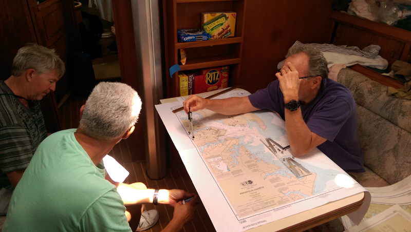
Charles. This was a lengthy process with the four student crewmembers working
well as a team to prepare the basic plan using the paper NOAA Charts, USCG Light
List Volume 2, USCG Local Notices to Mariners #27/18 issued July 3, 2018, and
the Coast Pilot #3. After laying out the route and studying the various hazards
and opportunities, the team then programmed the waypoints for the cruise on the
Garmin 8212 chart plotter. At the end of this process, the entire crew was very
familiar with the navigation plan and details and were all keyed in to what to
expect navigationally.
We also reviewed the weather forecasts available on VHF
radio, online at the NOAA weather sites, and the Sirius weather satellite
downloads on the Garmin 8212 display. Also consulted with Captain Jochen
Hoffmann ashore at home about his observations and concluded that the weather
looked good for proceeding on the cruise, and that hurricane Beryl and tropical
depression Chris should not be threats
to us. At 1800 hours Chris took over as Student Skipper. Tuesday
Continuing through the remainder of the C & D Canal
under motor power (sailing without an engine is not permitted in the canal) we
reached the Canal exit into the Delaware River at Reedy Point at 0900. After
taking manual compass bearings to ensure that we were fully past Reedy Point and
the rock jetties that border it, we turned south onto our course and into a two
knot opposing current. We could clearly see the Salem Nuclear Power Plant ahead
and to our port side on the New Jersey banks of the river. The cooling towers of
this plant are very large and their view will be with us for a long way down the
river. Winds remained very light and from ahead for most of our
way down the river and bay. We tried some motor sailing during the day, but all
we accomplished was to flog the sails with little or no benefit, so we furled
sails and motored most of the way. When we passed Brandywine Shoal Light at 1600 we began
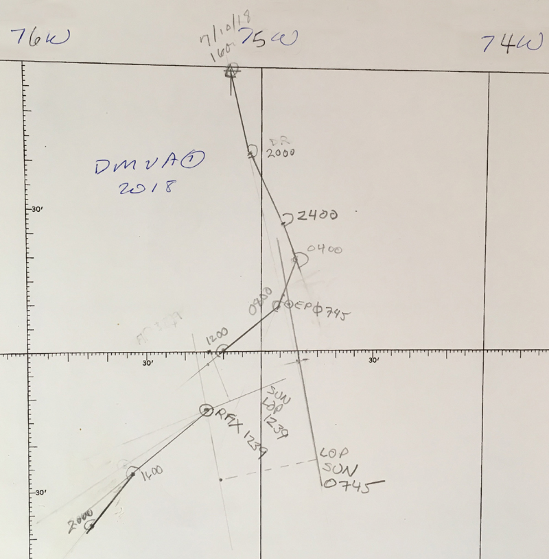
plotting our dead reckoning position (DR) on a DMA 926 position plotting sheet
with the intention of continuing this down the coast to Cape Charles. At 1730 we had dinner of beans and franks and were just
passing Brown Shoal Light at the south end of the Delaware Bay ship channel.
From here the deep water widens out and we are away from the persistent shoaling
that borders the ship channel for the entire length of the river and bay down to
this point. The weather is still bright and clear, and it's becoming a little
cooler as the afternoon progresses; winds have increased to 8 knots from the
south and remain pretty much on our nose as we continue to motor. At 1800 hours
Dean took over as Student Skipper. After rounding Cape Henlopen, we changed course a little
further south to parallel the ship exit lane from Delaware Bay. Wind remained
light and on our nose and we continued to motor.
Wednesday At 0730 with three sail up full and 12 knots of wind from SW, we're sailing at 4.5 knots on a beautiful sunny day and roughly parallel to our rhumbline. At this time Marc D took a sun shot with his sextant and,
using the GPS position as a reference, came within 1.6 miles compared with our
actual position. This was the first sun shot he had ever taken underway at sea
and it was quite good even for an experienced navigator. Marc plotted this line
of position (LOP) on the DMA 926 plotting sheet for later use in a running fix.
Then at 1230 Marc took another sun shot, plotted this LOP, and crossed it with
his earlier LOP using running fix procedures for a position fix. This procedure
well illustrated to these advanced coastal students how the DR plot and
celestial lines of position can be used to improve or correct the accuracy of
your navigational plot.
By 1300 the wind clocked (veered) to the NW and then to the
N and NE and dropped to 6 knots so we furled the genoa and motorsailed with the
mainsail remaining up. At 1800 hours Mark D took over as Student Skipper. Chris plotted the closest point of approach (CPA) of
another vessel on the radar maneuvering chart using AIS range and bearing data,
and determined that the other vessel would pass 2 miles ahead of us. This is an
important benefit of the manual plot as compared with he AIS forecast of CPA, which does not
tell whether the other vessel will pass ahead or astern of you. Range
and bearing data for this technique can also be determined by tracking the other
vessel on radar. The new DMVA Training Plan book has worked out well from
the standpoint of helping to keep students coordinated and in step with one
another when doing a sail handling procedure, and fostering improved team
building. When planning to do a sail change, the designated leader of that
procedure would take 10 minutes to study the procedure in the book, and then
David would be the reader ticking off the sub-titles, and I would be the
explainer as needed, but trying by this time to have the student crew doing it
without additional instruction from me if possible. This worked well except when
a crewmember jumped ahead of the team and prematurely did a step out of order
such as releasing the mainsail halyard before the boat was turned head to wind
thus potentially allowing the halyard to wrap a spreader. Also forgetting to
properly flake lines was a problem that gradually improved as the cruise
progressed. And one procedure that was universally forgotten was to immediately
crank tight on the mainsheet to stabilize the boom for the deck crew when the
mainsail halyard was released when dropping the sail; this requires advance
preparation to ensure that the mainsheet is wrapped on its winch and the handle
is inserted before releasing the main halyard. Cross track error is one area that the student crew
consistently had trouble with on this cruise and other cruises. As the name
implies, cross track error is the distance that the boat has strayed, either
right or left, of it's intended track. This track is laid down by the electric
chart plotter when we select a waypoint destination to steer to. The compass
bearing to that waypoint is indicated either by the electronics or by pencil
plotting on the chart, and the helmsman is instructed to steer to that bearing
on the ship's steering compass. But, position errors continuously accrue when
following a compass bearing due to many factors including water current, wind
leeway, steering errors and compass errors, and after a while the boat may have
strayed considerably off to one side or the other from the original track. The GPS indicates how far the boat is off track, and this
can inform the helmsman of the need to slightly bias his steering to minimize
this off track error. For example, if the destination waypoint bears 150º per
ship's compass (psc) the helmsman will steer to maintain that heading on the
compass. But while doing so, the cross track error on the GPS indicates that the
boat is gradually drifting away from the original track, let's say to the left
of track. So the helmsman slightly modifies his steering to reduce this error,
and begins to steer a little to the right, let's say 152ºpsc, and notices that
the cross track error stops increasing. The helmsman need not make large steering changes to
quickly eliminate the cross track error, but simply remain cognizant of the
error and gradually bias steering right or left to minimize the error. So the
compass bearing to waypoint is the big-picture guide as to what the helmsman
should steer, and the cross track error is the fine-tuning to be continuously
monitored and minimized. This applies when motoring without sails to a
waypoint or when sailing free on a reach, but does not apply to sailing
close-hauled when the wind and sails are in control of what needs to be steered. It's interesting to note that with the cooler weather of
previous days we had virtually no flies. But here on Wednesday with warmer
weather, we have flies. It's also interesting to speculate on how they get here
since we have been 20 miles or so from land yesterday and today... How do they
get here!! At 1800 hours Mark D took over as Student Skipper. On Wednesday as evening approached we were about ten miles east of Cape Charles and the Chesapeake Bay entrance and motoring toward our entrance marker Flashing Red Lighted Buoy "2N" where we would turn north and head for the bridge; actually there are two bridges in line that we need to pass under. Sirius Weather on our multi-function display showed heavy rain squalls approaching Cape Charles from the west, and it looked like we were in for an unavoidable drenching. All hands were now on watch with assignments made as follows:
Sure enough, the rains hit in a torrential downpour as we
approached Red "2N" but our well-rehearsed crew performed flawlessly
in the driving rain and limited visibility. As we passed buoy "2N" and
turned north toward the bridges about a mile distant, the rains abated and
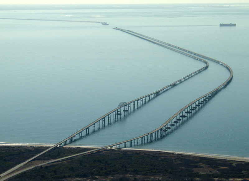
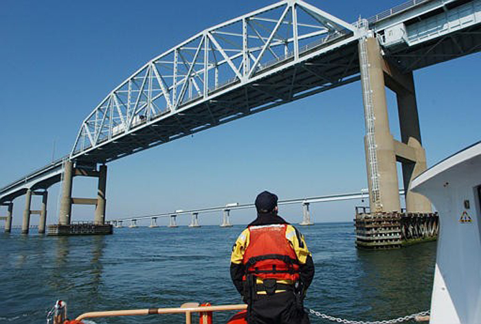
visibility improved markedly. We could clearly see the vital green range lights
hanging below the bridge spans, and it was essential for us to align our
position so that these lights were in alignment and pointing the way directly
under the bridges. To achieve this alignment, we had planned our route to
bring us between the unlighted buoys G"11" and R"10" several
hundred yards south of the first bridge, then bear to the right toward the
eastern abutment of the first bridge until the four green range lights (two on
each bridge) all fell into alignment thus indicating the direct route under both
bridges. As we turned toward the bridge, the lookouts played their spotlights on
the bridge abutments to assist the helmsman with maintaining appropriate
distance from these abutments.
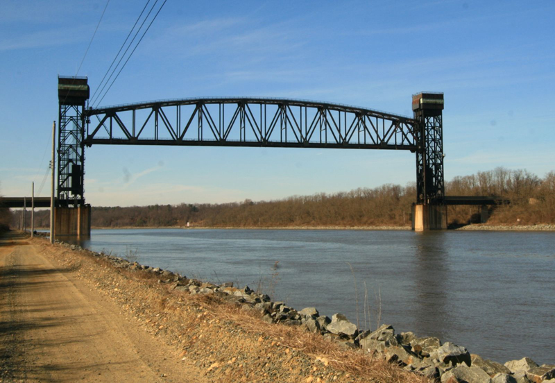
As we passed under the bridges, we saw a 150 foot fishing
vessel on the north side of the bridges headed toward us bow-on to us but a
little off to our portside. He shined his bright spotlight directly at us to
ensure that we saw him. The fishing boat was at all stop allowing us to complete
our passage under the bridge and pass port to port. As we passed, we recognized
this fisherman as one of the menhaden fishing fleet that ply the waters of the
southern Chesapeake Bay and near coastal areas. Thursday Cape Charles town has a narrow, winding but well marked
entrance channel with range lights and some unlighted buoys needing special
attention in the dark of night. We passed Old Plantation Flats Light to
starboard and just beyond this was Green Lighted Buoy "1CC" at which
we turned to starboard and left it to port as we entered the channel. Guided by
our navigation plan, charts, chart plotter, range lights, buoys and our deck
lookouts, we proceeded up the channel and to the town basin and marina. We then
had to grope along the shoreline shining spotlights to identify where best to
tie up. We selected a promising looking T-head dock, approached it portside to,
Mark H stepped ashore with mooring lines and secured. We hooked up the shore
power, turned on the air conditioning, and soon thereafter all went to bed for a
welcomed good nights sleep at 0200 on Thursday. Thursday morning all were up by 0900 to face another bright
and sunny day, took showers at the marina and went to breakfast in town at a
pleasant little restaurant. We then returned to the boat and worked up the
navigation plan for the coming overnight sail up the bay to Annapolis, settled
accounts with the marina, and departed Cape Charles by 1600 that afternoon. At
1800 hours Mark H took over as Student Skipper. Weather was warm and getting humid with winds ENE at 8 to
12 knots making for a pleasant reach under single reefed mainsail and full
genoa. Earlier there were reports of a waterspout nearby but we saw none of it. Just after dark we did a nighttime man overboard drill
using the strobe-lighted Weenie, quickly stopping the boat with a tack-and-back
maneuver from a close-hauled heading. We furled the genoa, eased the mainsheet
and started the engine to maneuver upwind and beam to the victim, and used the
MOB plastic grapnel hook to retrieve it on first attempt. As we stopped the boat
quickly, we ended up close to the victim in the water with good visibility of
the strobe light and saw no need to deploy the horseshoe-pole-strobe rig as this
would only complicate recovery and serve no real purpose in this situation. Had
we not been close to the victim, or not had good visibility of the victim, we
would have deployed the horseshoe-pole-strobe rig. Shortly after this exercise, at about 2130 hours, we
received a VHF radio call from an MSTS ship that was coming up the Chesapeake
Channel behind us. We were out of the channel at the time, but he was concerned
that we would be too close for comfort when he exited the north end of the
channel. He was now about five miles behind us and traveling at 18 knots, so the
encounter would take place soon. He also said there was another MSTS ship a few
miles behind him who we'd also need to deal with. The first ship asked us to
steer a little more westerly of our current course and leave the Red and White
"RP" buoy to our starboard side, and he would leave it to his
portside. We of course agreed to this and altered course accordingly. We then
contacted the second ship who said they had monitored our communication with the
first ship, and they would follow the same plan leaving the "RP" buoy
to their portside. Both ships passed us at a half-mile distance to our
starboard, and all was well. Eeventhough winds continued from the east at 8 to 15 knots
giving us a nice beam reach, we left the motor running and continued
motor-sailing to allow us to conserve electrical power so that we could keep the
radar on full time for safety in the nighttime hours. So now we are making good
progress under single reefed mainsail and full genoa toward a waypoint to the
east of the Smith Point traffic lanes. Friday We arrived at Annapolis Harbor at 1300 on Friday and went directly to the Annapolis Yacht Basin, topped up our diesel tank, pumped out the holding tank and flushed it with a full load of fresh water then pumped it out again. Initially, we picked up a mooring for practice and called the Harbor Master by cell phone and asked for a slip of which there were none available. But he said he might be able to get us in alongside the quay, which we accepted if there was electrical power, which there was. So the Harbor Master moved some boats a little this way and a little that way along the quay making a 41 foot space for our 40 foot boat. We shoe-horned into that space, secured our docklines, connected electrical, turned on the A/C to cool down, took showers and went to dinner ashore at the Boatyard Bar and Grill as recommended by Dean.
At 1800 hours Chris took over as Student Skipper. After
dinner we returned to the now cooled down boat, and the student crew wrote their
ASA106 examinations. After this we spent about an hour and a half reviewing the
Part B skills list on the back of the ASA exam booklet, and made some
preliminary plans for the next day's return cruise to rock Hall. Then we went to
town for ice cream and had a grand time looking at the Friday night scene on the
streets of Annapolis as passers-by of all stripes and shapes entertained us. We
then returned to our cool and snug boat, closed the hatches and turned out the
lights for a good night's rest after our overnight passage the previous night. Saturday
Wind was very light from the south, so we motored back
across the bay, rounded Love Point and into the Chester River. After passing the
horseshoe turn at the southern end of the Chester River, we put up the mainsail,
deployed the whisker pole and sailed wing-on-wing up the river to Green Can
"3" where we struck the genoa and pole, motored to Cacaway island and
dropped the mainsail. Then we motored to our slip at Lankford Bay Marina and
backed in for a perfect landing at 1630 after our most enjoyable 400 mile cruise
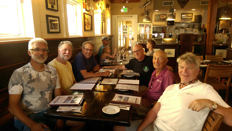
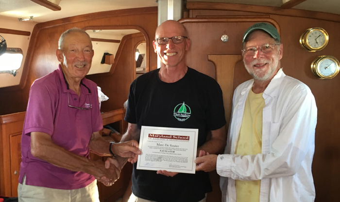
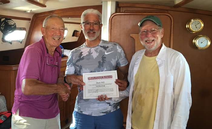
around the DELMARVA peninsula. The crew cleaned up the boat, emptied trash, collected
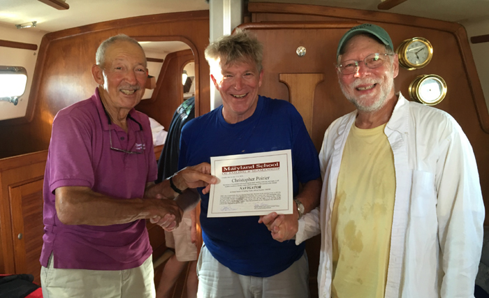
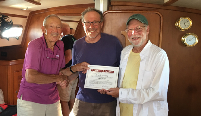
their personal gear and headed home, but not until we had a diploma award
ceremony:
Captain Tom Tursi
|
Web site design by F. Hayden Designs, Inc.